The DEMMIN landscape laboratory of the Geoecology working group (in cooperation with the Geoforschungszentrum Potsdam and the German Aerospace Centre in Neustrelitz) in the north-east of Mecklenburg-Western Pomerania in the area between Demmin, Jarmen and Greifswald is initially used for the long-term, automatic monitoring of agrometeorological environmental parameters in an intensively used agricultural study area. A wide range of questions are being addressed, e.g:
- Area-based analysis of agrometeorological parameters for agricultural studies and modelling.
- Development and maintenance of an open data portal for integration into agricultural practice
- Calibration and validation of remote sensing data through in-situ measurements
- Linking of field measurements with remote sensing data for upscaling and areal environmental modelling
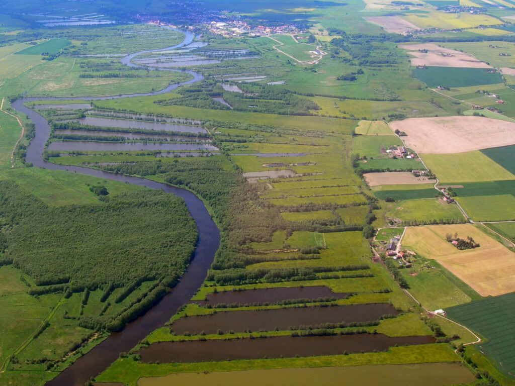
From a natural geographic point of view, the DEMMIN test area is heterogeneous. The present surface shape of the young moraine landscape of Mecklenburg-Vorpommern is mainly the result of glacial deformation. Today, the area is mainly used for agriculture. The fens are used for grassland. Some of these fen sites have been rewetted as part of renaturation measures. Forests are largely restricted to the moraine sites. As a result of the high site variability, the spatial and temporal changes in a small space within the comparatively large plots (>100 ha) have to be taken into account in the management, so that a sub-plot-related management is necessary.
In total, more than 40 weather stations and more than 65 soil moisture measuring points are operated automatically for environmental monitoring in the study area. Since DEMMIN was launched in 1999, the database has been continuously expanded. On the one hand, farmers provide new information on precision agriculture every year, such as yield and nutrient maps. On the other hand, the database is expanded by various research activities accompanied by aerial photography and soil measurements (e.g. AgriSens DEMMIN 4.0).
The cultivated areas of the cooperating farmers cover approx. 30,000 ha. The area is particularly suitable for scientific applications of remote sensing, as the site heterogeneity (e.g. landscape types, geology, soil, water conditions, land cover, land use) is high with an average field size of about 80 ha. The main crops grown are winter cereals (e.g. winter wheat, barley, rye), which cover almost 60% of the fields. The area for maize, sugar beet and potatoes is about 13%.
The DEMMIN landscape laboratory is located directly in the orbit of various earth observation satellites (Sentinel-1+2, Landsat 8) and is thus ideally suited as a calibration, validation and environmental upscaling and modelling site. Within the framework of field and student campaigns carried out several times a year, various agrometeorological, phenological and biophysical parameters are collected in the course of standardised sampling, which are suitable for integration into the processing of agricultural questions and the analysis of remote sensing data (e.g. leaf area index, chlorophyll content, above-ground biomass).
Partner on site:
- Daberkower Landhof
- Bentziner Ackerbaubetrieb
- Hochschule Neubrandenburg
- DLR Neustrelitz