Research Land System Science
All landscape laboratories are visited as part of courses in the geography programme. The results collected in the landscape labs can be the basis for final theses and are sometimes also used in projects. The focus of each landscape laboratory varies due to the natural features of the area, but usually includes identical learning objectives and content depending on the semester of study.
Current projects
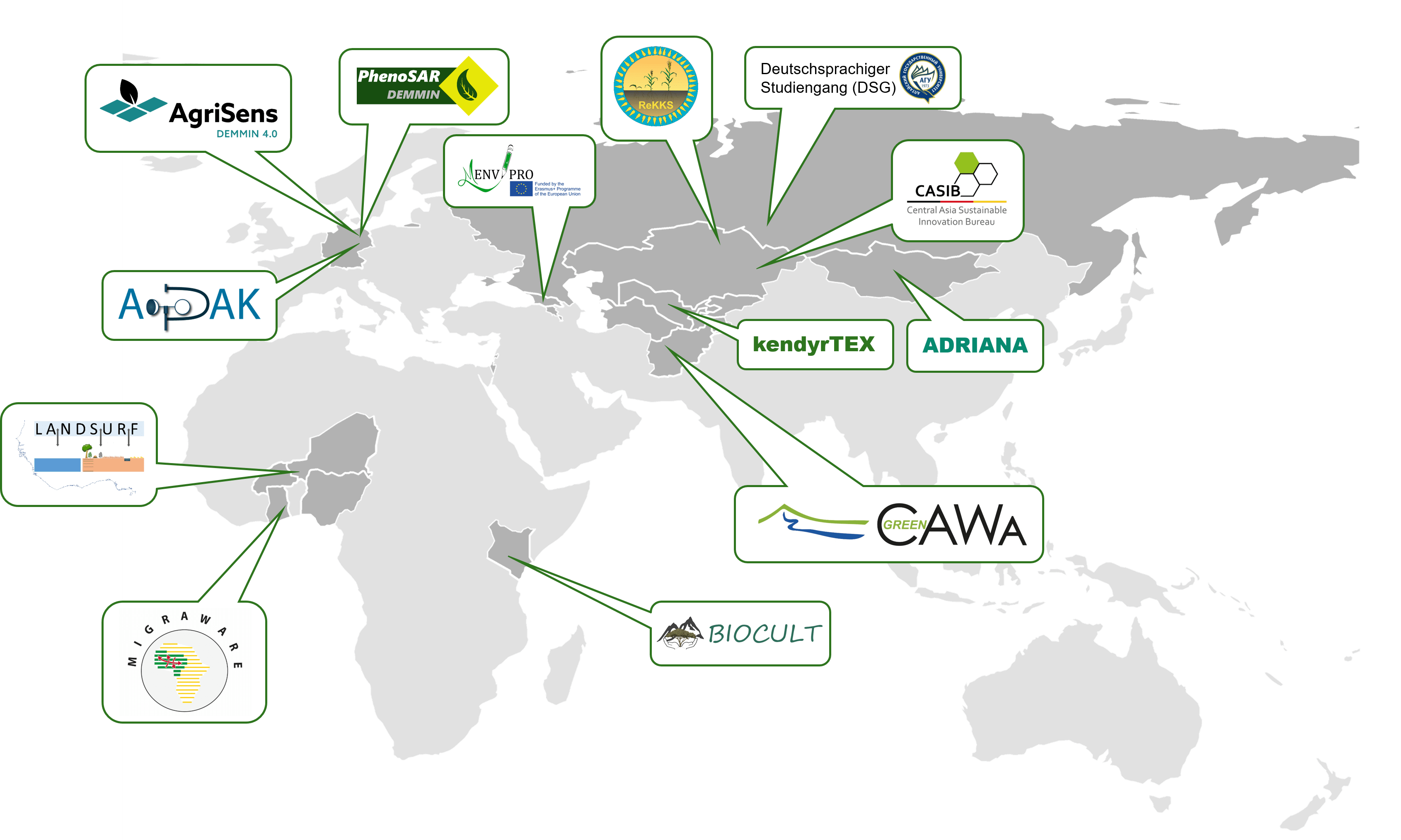
EU for a green Turkmenistan
Turkmenistan is affected by climate change, facing significant challenges today with increasing potential in the future. Climate change caused by, among others, methane and greenhouse gas emissions (GHG) into the
DiP-SMART Agroforst
Project description Global climate change the associated increase in extreme weather events, as well as a structural transformation in the former Central German mining region, pose severe challenges for regional
DIP-ZAZIkI
The aim of this project is to develop and evaluate resource-conserving and practical cultivation systems for sugar beet in the model region of Mitteldeutsches Revier in Saxony-Anhalt. The new cultivation
DIP: FaiReSyst
The digital transformation, globalization, and demographic change pose challenges to the economy. The agricultural sector plays a significant role in the plant value chain and regional competitiveness. Given the noticeable
CoolTown
Development of a remote sensing service to contribute to the mitigation of urban heat island effects and the adaptation of urban green spaces to drought and heat stress in the
CASIB
The Project Office for Sustainable Innovations in Central Asia supports research and development projects between Germany and the Central Asian countries in the thematic areas of climate, environment and energy.
Green Central Asia
Funded by the Federal Foreign Office of Germany, the CAWa-Green project in the “Green Central Asia Initiative” frame intends to contribute to a sound scientific and reliable regional data basis
AgriSens DEMMIN 4.0
Der globale Wandel hat eine Reihe von Umweltveränderungen befördert, wie z.B. den Klimawandel, Veränderungen der Wasserressourcen, der chemischen Zusammensetzung der Atmosphäre, der Ökosysteme und letztendlich auch der landwirtschaftlichen Produktivität. Die
GM-GDE
Groundwater resources are biodiversity hotspots and provide important ecosystem services. Groundwater-dependent ecosystems (GDEs) are exposed to anthropogenic threats such as climate change. In order to respond to these threats, the
KendyrTex
The project focuses on the production of a cotton-like fibre quality that, as a blending partner, allows processing on locally available cotton textile machines. A German-Central Asian consortium of a
PhenoSAR DEMMIN
The PhenoSAR-Demmin project investigates the derivation of phenological times and periods from remotely sensed time series according to the current state of scientific knowledge. Data from the Sentinel-1 mission are
Recent publications
Ongoing Dissertations
- Barasso C Uncertainties in satellite-based global time-series of land use/land cover, Centre for Integrative Biodiversity Research (iDiv) Halle-Jena-Leipzig, GeoKur
- El-Hokayem L Identifying threathened groundwater dependent ecosystems as local biodiversity hotspots in Saxony-Anhalt and globally via remote sensing, Martin LutherUniversity Halle-Wittenberg & German Centre for Integrative Biodiversity Research (iDiv)
Halle-Jena-Leipzig, GM-GDE - Koza M Effects of agriculture on wind erosion in the dry steppe of Kazakhstan, Martin Luther University Halle-Wittenberg, ReKKS
- Loew J An evaluation of Sentinel-1 based PolSAR and InSAR time series for tracking crop phenology, Martin Luther University Halle-Wittenberg, PhenoSAR DEMMIN, AgriSens DEMMIN 4.0
- Piernicke T Application of Remote Sensing Technologies for Irrigation Strategies in Agriculture, Helmholtz Centre Potsdam
GFZ German Research Centre for Geosciences, AgriSens DEMMIN 4.0 - Mahmood T Agricultural Monitoring using multi-temporal optical and SAR data in Complex Cropping Zone, Martin Luther University Halle-Wittenberg
- Reichmuth A Analysis of forest condition changes using multi-spectral time-series, Helmholtz-Zentrum für Umweltforschung GmbH – UFZ, Waldzustandsmonitor
- Schürmann A Assessing the drivers, factors, and routes of internal and cross-border migration in West Africa, Martin-Luther-Universität Halle-Wittenberg, MIGRAWARE
- Wenzel J Combining soil hydraulic properties with starch potato yield and quality parameters for an optimized intra-site irrigation management, Martin Luther University Halle-Wittenberg, AgriSens DEMMIN 4.0
Completed projects
MIGRAWARE
The MIGRAWARE project aims to identify and analyse historical, current and future migration movements in West Africa. This analysis will be carried out against the
ADRIANA
The sustainable use of natural geo-resources and the efficient use of valuable materials are gaining in importance worldwide. Against this background, anthropogenic deposits such as
DSG
The German-language degree programme “Environmental Monitoring and Planning” has existed since 2007 and was originally conceived as a postgraduate programme. “Environmental Monitoring and Management”. The
Completed dissertations
The Department of Geoecology maintains four landscape laboratories that extend from the central and lower Harz mountains, the eastern Harz foreland, the Helme-Unstrut stratified plain and the Querfurt plate to the Finne on the one hand and to Mecklenburg-Western Pomerania in the north-eastern German lowlands on the other. The Central German drylands, loess landscapes as well as the young moraine landscape with typical periglacial landscape elements such as extensive, flat sandy areas, hills and depressions are covered.
The research topics include land use systems, water and landscape budgets in agricultural landscapes and small catchment areas. Specifically, long-term monitoring of runoff and water quality is conducted along the Salza River, and research is conducted at the TERENO site DEMMIN on remote sensing monitoring and the use of remote sensing for precision agriculture. The Agricultural and Food Research Centre (AEVZ) Merbitz is used to answer soil and agri-geographical questions. Accordingly, the landscape laboratories are equipped with field measurement technology and are sampled in campaigns on a regular or question-based basis.