StartStaff

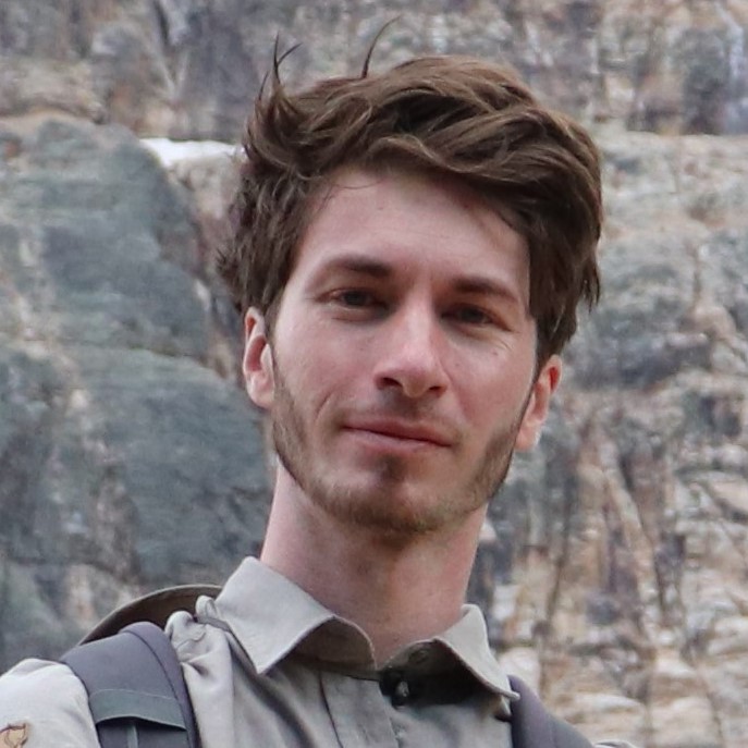
Dr. rer. nat. Michael Denk

Research focus
  • Multi- and hyperspectral remote sensing
  • Field and laboratory spectrometry
  • Exploration of anthropogenic deposits
  • Remote sensing in the mine life cycle
Scientific career
  • since 08/2021
    Scientist in the Department of Geoecology, Institut of Geosciences and Geography, Martin Luther University Halle-Wittenberg
  • 07/2018
    PhD (Dr. rer. nat.) on „Qualitative and quantitative spectral characterisation of iron- and steelworks by-products: combining information from the visible light to the longwave infrared”
  • 08/2015 – 07/2021
    Research assistent in the Department of Geoscientific Remote Sensing, Institute of Geosciences and Geography, Martin Luther University Halle-Wittenberg
  • 08/2012 – 07/2015
    Research assistant in the BMBF joint project “REStrateGIS”, Institute of Geosciences and Geography, Martin Luther University Halle-Wittenberg
  • 08/2011 – 07/2012
    Scholarship holder supported by the Graduate Funding of the State of Saxony-Anhalt
  • 12/2010
    Diploma Thesis „Reflexionsspektrometrische Inventarisierung mineralischer Oberflächen und sekundärer Mineralneubildungen in der Bergbaufolgelandschaft bei Teutschenthal“
  • 10/2003 – 05/2011
    Study of geography (major), geology and soil science (minors) at the Martin Luther University Halle-Wittenberg
Current projects

Publications

1
Mammadov, E., Denk, M., Mamedov, A.I. and Glaesser, C. (2024) Predicting Soil Properties for Agricultural Land in the Caucasus Mountains Using Mid-Infrared Spectroscopy. Land, 13, 154. https://doi.org/10.3390/land13020154.
1
Tepanosyan, G., Muradyan, V., Tepanosyan, G., Avetisyan, R., Asmaryan, S., Sahakyan, L., Denk, M. and Gläßer, C. (2023) Exploring Relationship of Soil PTE Geochemical and “VIS-NIR Spectroscopy” Patterns near Cu–Mo Mine (Armenia). Environmental Pollution. https://doi.org/https://doi.org/10.1016/j.envpol.2023.121180.
1
Ogen, Y., Denk, M., Glaesser, C. and Eichstaedt, H. (2022) A Novel Method for Predicting the Geochemical Composition of Tailings with Laboratory Field and Hyperspectral Airborne Data Using a Regression and Classification-Based Approach. European Journal of Remote Sensing, 55, 453–470. https://doi.org/10.1080/22797254.2022.2104173.
1
Mammadov, E., Denk, M., Riedel, F., Kaźmierowski, C., Lewinska, K., Łukowiak, R., Grzebisz, W., Mamedov, A.I. and Glaesser, C. (2022) Determination of Mehlich 3 Extractable Elements with Visible and Near Infrared Spectroscopy in a Mountainous Agricultural Land, the Caucasus Mountains. Land, 11, 363. https://doi.org/10.3390/land11030363.
1
Ogen, Y., Denk, M., Glaesser, C., Eichstaedt, H., Kahnt, R., Loeser, R., Suppes, R., Chimeddorj, M., Tsedenbaljir, T., Alyeksandr, U. and Oyunbuyan, T. (2021) Quantification of the Spectral Variability of Ore-Bearing Granodiorite under Supervised and Semisupervised Conditions: An Upscaling Approach. Journal of Spectroscopy, 2021, e2580827. https://doi.org/10.1155/2021/2580827.
1
Mammadov, E., Denk, M., Riedel, F., Lewinska, K., Kaźmierowski, C. and Glaesser, C. (2020) Visible and Near-Infrared Reflectance Spectroscopy for Assessment of Soil Properties in the Caucasus Mountains, Azerbaijan. Communications in Soil Science and Plant Analysis, 51, 2111–2136. https://doi.org/10.1080/00103624.2020.1820027.
1
Eichstaedt, H., Tsedenbaljir, T., Kahnt, R., Denk, M., Ogen, Y., Glaesser, C., Loeser, R., Suppes, R., Alyeksandr, U., Oyunbuyan, T. and Michalski, J. (2020) Quantitative Estimation of Clay Minerals in Airborne Hyperspectral Data Using a Calibration Field. Journal of Applied Remote Sensing, 14, 034524. https://doi.org/10.1117/1.JRS.14.034524.
1
Nühlen, J., Denk, M., Gläßer, C., Teuwsen, S. and Algermissen, D. (2016) Sekundärrohstoffe in Hüttenhalden – Strategien Zur Haldendetektion Und -Analyse Auf Basis von Geoinformationstechnologien. Mineralische Nebenprodukte Und Abfälle, TK Verlag Karl Thomé-Kozmiensky, 359–382.
1
Nühlen, J., Mrotzek-Blöß, A., Jandewerth, M., Denk, M., Gläßer, C., Algermissen, D., Mudersbach, D., Teuwsen, S. and Müterthies, A. (2016) REStrateGIS – Konzeption Und Entwicklung Eines Ressourcenkatastens Für Hüttenhalden Durch Einsatz von Geoinformationstechnologien Und Strategieentwicklung Zur Wiedergewinnung von Wertstoffen. Innovative Technologien Für Ressourceneffizienz – Strategische Metall Und Mineralien. Ergebnisse Der R3-Fördermaßnahme., 311–328.
1
Jandewerth, M., Denk, M., Gläßer, C., Mrotzek, A. and Teuwsen, S. (2013) Reduktion von Rohstoffimporten Durch Wertstoffgewinnung Aus Hüttenhalden – Entwicklung Eines Multiskalaren Ressourcenkatasters Für Hüttenhalden. Aschen – Schlacken – Stäube. Aus Abfallverbrennung Und Metallurgie., TK Verlag Karl Thomé-Kozmiensky, 639–657.
1
Denk, M. and Gläßer, C. (2011) Reflexionsspektrometrische Erfassung von Stoffausträgen Aus Kalihalden Am Beispiel Der Bergbaufolgelandschaft Bei Teutschenthal. Proceedings Der 31.Wissenschaftlich-Technische Jahrestagung Der DGPF, Mainz, 303–310.
1
Denk, M. and Gläßer, C. (2011) Mapping Of Environmental Impacts Of Salt Mining Dumps In Central Germany Using Spectroradiometric Methods. Proceedings of the 7th Workshop of EARSeL SIG Imaging Spectroscopy, Edinburgh, 6.
1
Denk, M. (2022, December 11) Assessing the Composition of Porphyry Copper Tailings Using Visible Light to Longwave Infrared Reflectance Spectroscopy. Poster, Enschede.
1
Ogen, Y. (2022, December 11) Identifying Copper Hot Spots in the Subsurface of an Operational Tailing’s Facility Using Landsat Time-Series Analysis. Presentation, Enschede.
1
Denk, M. (2022, June 22) Exploring Porphyry Copper Tailings With Visible Light To Long Wave Infrared Reflectance Spectroscopy – A Case Study In Erdenet, Mongolia. Presentation, Potsdam.
1
Denk, M. (2022, June 22) DETECTING SOIL ORGANIC CARBON IN AGRICULTURAL SOILS ADJACENT TO MINING AREA USING PROXIMAL SENSING SPECTROSCOPY. Poster, Potsdam.
1
Ogen, Y. (2022, June 22) Utilizing Lidar Intensity Data to Improve Copper and Molybdenum Prediction Models in a High-Wetness Environment. Presentation, Potsdam.
1
Ogen, Y., Denk, M., Gläßer, C. and Eichstaedt, H. (2021, 12.-14.12) A Novel Method For Predicting The Geochemical Composition Of Tailings With Laboratory Field And Hyperspectral Airborne Data Using Regression And Classification-Based Approach. Talk, London.
1
Tepanosyan, G., Tepanosyan, G., Muradyan, V., Asmaryan, S., Sahakyan, L., Denk, M. and Gläßer, C. (2021, 06.-10.06) Detecting Potentially Toxic Elements In Agricultural Soils Adjacent To Mining Area Of Kajaran, Armenia Using VIS-NIR Spectroscopy. Talk, Warsaw.
1
Denk, M. and Gläßer, C. (2019, 02.-08.02) Exploration of Iron- and Steelworks Dump Sites – Using Spectral Data from the Visible Light, Near- and Shortwave Infrared (350-2500 Nm) to the Mid- and Longwave Infrared (2500-15000 Nm). Talk, Brno.
1
Nühlen, J., Denk, M., Gläßer, C., Teuwsen, S. and Algermissen, D. (2016) Sekundärrohstoffe in Hüttenhalden. Das Projekt REStrateGIS Zeigt Neue Strategien Zur Haldendetektion Und –Analyse Auf Basis von Geoinformationstechnologien Auf. ReSource Abfall, Rohstoff, Energie ; Fachzeitschrift für nachhaltiges Wirtschaften, 29, 4-15.
1
Witzke, T. and Denk, M. (2011) Eine Temporäre Mirabilit-Mineralisation Bei Teutschenthal, Sachsen-Anhalt. Der Aufschluss. Zeitschrift für Mineralogie und Geologie., 2011, 353–360.

Supervised theses

1.
Berndsen J (2022) Fernerkundliche Analyse von Tagebauhalden mittels World-View 3 und Sentinel-2 Satellitenbilddaten am Beispiel der Cu-Mo Lagerstätte Erdenet – Mongolei. Martin-Luther-Universität Halle-Wittenberg
1.
Artin K (2022) Application of GIS and Remote Sensing methods for assessment of groundwater potential zones in the Kodavanar river basin, India. Martin-Luther-Universität Halle-Wittenberg
1.
Mielke J (2020) GIS gestützte Volumenberechnung von Wölbäckern am Standort Rathsleben (Altmark) – ein Vergleich zwischen Laserscanning und Tachymetrie. Martin-Luther-Universität Halle-Wittenberg
1.
Eisner J (2023) Städte im Hitzestress – Eine Analyse der Intensitätsentwicklung urbaner Wärmeinsel-Effekte unter Berücksichtigung des Versiegelungsgrades am Beispiel der Stadt Leipzig. Martin-Luther-Universität Halle-Wittenberg
1.
Kühn AK (2022) Multitemporale Landschaftsanalyse von Ausgleichsküsten am Beispiel des Neudarß. Martin-Luther-Universität Halle-Wittenberg
1.
Lichtenberg J (2022) Geomorphologische Prozesse und Entwicklungen an der Boddenausgleichsküste des Neu-Darß von 1991 bis 2019. Martin-Luther-Universität Halle-Wittenberg
1.
Stöcker L (2021) Vergleichende Analyse von spektrometrischer Feldmessungen und UAV-Daten zur Untersuchung der biophysikalischen Vegetationsparameter der Zuckerrübe. Martin-Luther-Universität Halle-Wittenberg
1.
Brandstäter JHO (2020) Satellitengestützte Exploration des Erdenet Bergbaukomplexes mittels Sentinel-2-Daten. Martin-Luther-Universität Halle-Wittenberg
1.
Michael MÉ (2020) Entwicklung eines WebGIS für den Park Dieskau. Martin-Luther-Universität Halle-Wittenberg
Dr. rer. nat. Michael Denk