Studying Geoecology
Studying Geoecology in Halle
The study programme begins with physical geography: climate, hydro, soil and vegetation geography as well as geoecology. Specialisations in geology, soil science or botany are possible. Methodologically, we offer the entire range of geoecological data acquisition. Two project studies and an internship serve to deepen practical knowledge. Our MSc offer focuses on the analysis of land use systems by means of field and laboratory recording, remote sensing and modelling. In teaching, we increasingly use a blended learning approach. We are happy to advise you.
Field and Lab
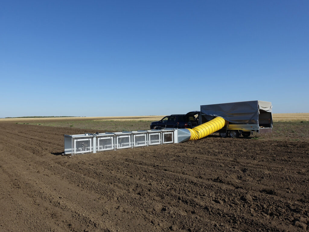
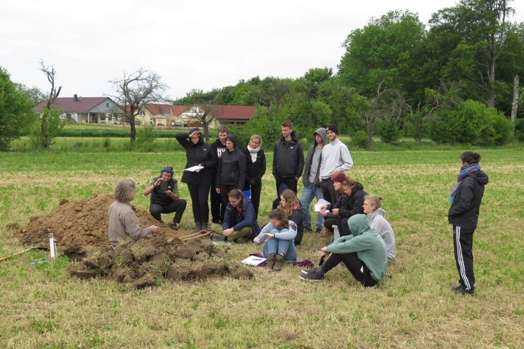
The course teaches methods for recording various environmental parameters such as climate, soil, vegetation and water in the field. Using extensive measurement technology, our students sample landscape laboratories and project areas. Soil physics as well as soil and water chemistry analysis methods are learned in the geoecology laboratory. In the project studies of the BSc and in the MSc programme, the data obtained are evaluated above with regard to geographical questions. We attach great importance to digital input and provision of the measurement data from our courses.
Remote Sensing and Geodata
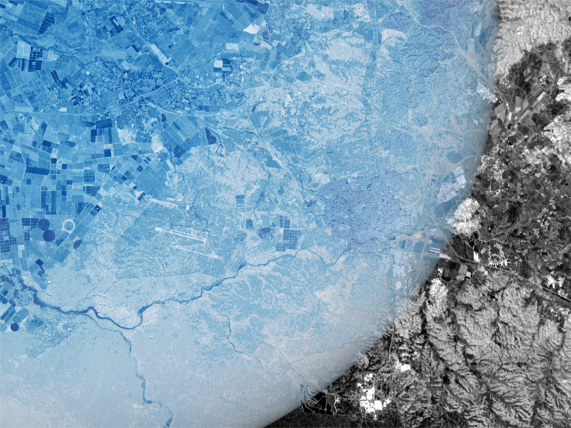
A special feature in Halle is the combination of terrain and laboratory recording with remote sensing and geodata integration. Thus, procedures for extrapolating the point measurements to the landscape level are part of the teaching programme. For this purpose, we have a UAV fleet with extensive sensor technology at our disposal (optical, thermal and LiDAR data). Likewise, satellite data and climate projections are evaluated in the study programme for the analysis of land use systems. The basics in R-statistics are already laid in the BSc programme. The courses are coordinated with the “Digital Geography” department.
Human-environment interactions
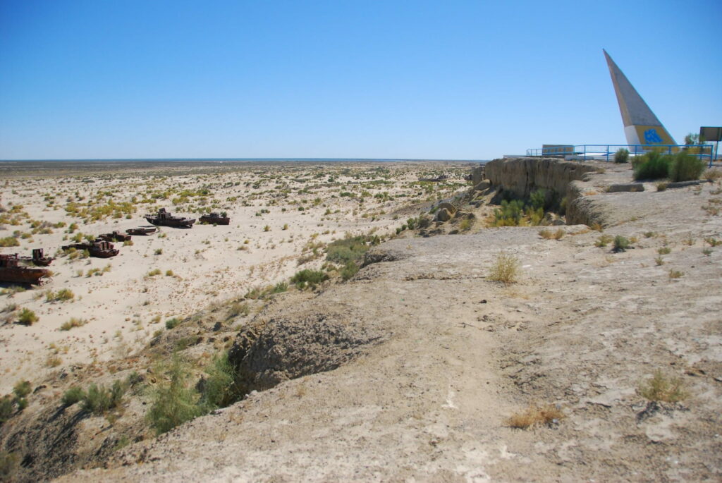
All of our advanced courses provide content on current issues of human-environment relations, for example in agricultural landscapes and river basins. In the MSc programme “Global Change Geography – International Area Studies” we focus on the challenges of global change for geoecosystems and examine research approaches to land use systems, soils and water and material flows, for example against the background of “telecoupled systems” or the “water-energy-food nexus”. Thesis opportunities are available in our projects, for example on issues of land and water management in Central Asia, Central Europe and Sub-Saharan Africa.
We offer courses for all BSc and MSc programmes in Geography as well as for the teaching profession. Some of these courses are also offered to students in the BSc and MSc Natural Resource Management and the international MSc Biodiversity Sciences.
We support equal opportunities and expressly advocate further academic qualification abroad.
Available theses topics
If you are planning to write your thesis in the Department of Geoecology, please do not contact the department staff directly.
Instead, send an e-mail to the secretary’s office of the Department of Geoecology (Ms. Nancy Trinks, nancy.trinks@geo.uni-halle.de) in which you outline your desired topic and time schedule in a few sentences, stating your name, first name, matriculation number and degree programme, as well as the desired reviewers or supervisors. The idea of possible topics for the thesis may still be very vague and you may also indicate several areas/fields for the thesis topic to be worked on.
Based on your outline of possible topics for the thesis, the most suitable reviewer(s) or supervisor(s) in terms of content will be selected.
As a rule, you will receive feedback by e-mail from the secretariat of the Department of Geoecology within four weeks.
- Charakterisierung von in-situ Konzentrationsmessungen von CO2 in verschiedenen Ökosystemen – Kontakt: Dr. Thomas Thienelt
- Charakterisierung der potentiellen und realen ET an Agrarstandorten – Kontakt: Dr. Thomas Thienelt
- Analyse UAV-basierter Landoberflächentemperaturdaten (LST) in Agroforstsystemen in Süd-Sachsen-Anhalt – Kontakt: Prof. Dr. Christopher Conrad
- Modellierung mittels Fernerkundung – Kontakt: Prof. Dr. Christopher Conrad
- Ableitung von Extremwetterindikatoren – Kontakt: Dr. Markus Möller
- Erfassung und Bewertung grundwasserabhängiger Vegetation und Ökosysteme – Kontakt: Léonard El-Hokayem
- Landnutzungswandel und Dynamik der Landoberfläche – Kontakt: Prof. Dr. Christopher Conrad
- Climatic variability across the Kenyan coastal forests – Kontakt: Dr. Mike Teucher
- Ableitung phänologischer Metriken und Phasen – Kontakt: Dr. Markus Möller
- Fusion von Satellitenbilddaten – Kontakt: Dr. Markus Möller
- Geoökologische Modellierung von Einflussfaktoren der Land-Use Intensity, Landschaftsstruktur und Geoökologischer Diversität auf die Wasserqualität von Stillgewässern in Deutschland – Kontakt: PD Dr. habil Angela Lausch
- Ableitung von Indikatoren der Land Use Intensity/Hemeroby mittels Remote Sensing, Traits, Patternrecognition sowie machine Lerning Ansätze (Clusterverfahren) aus in 14 Europäischen Testgebieten – Kontakt: PD Dr. habil Angela Lausch
- Ökologische Modellierung der Einflussfaktoren von Forest Intensity, Landschaftsstruktur, Variablen der Bio-Geodiversität auf den Borkenkäferbefalle im Nationalpark Bayerischer Wald – Kontakt: PD Dr. habil Angela Lausch
- Review-Arbeit: Zusammenstellung von existierenden Ansätzen und Indikatoren zur Ableitung und Quantifizierung der Hemeroby – Kontakt: PD Dr. habil Angela Lausch
- Review-Arbeit: Zusammenstellung von existierenden Ansätzen und Indikatoren zur Ableitung und Quantifizierung der Land-Use Intensity (LUI) in Agrar-Forst-und Urbanen Landschaften – Kontakt: PD Dr. habil Angela Lausch
- Review-Arbeit: Zusammenstellung von existierenden Ansätzen und Tools zur Semantic Data Integration von GIS und RS Daten – Kontakt: PD Dr. habil Angela Lausch
- Integrierte Einzugsgebietsanalyse und –modellierung (Einfluss von Landnutzung auf Wasser- und Nährstoffflüsse, Biodiversität, etc.) – Kontakt: Prof. Dr. Martin Volk
- Maßnahmen zur Wasser- und Nährstoffretention in Einzugsbieten – Kontakt: Prof. Dr. Martin Volk
- Trendanalysen (Landnutzung, Klimaparameter, Gerinneabfluss, ökologischer Mindestabfluss) – Kontakt: Prof. Dr. Martin Volk
- Comparative Analysis of HYDRUS-1D Model Simulations Using ERA5 Remote Sensing Data and Field-Based Soil Hydrodynamic Parameters in the Merbitz Region, Germany – Kontakt: Dr. Ing. Muhammad Usman
- Evaluation of Soil Moisture Data from ERA5 Using Sensor-Based Data in the DEMIN Region, Germany – Kontakt: Dr. Ing. Muhammad Usman
- Methodenvergleich Textur– oder Aggregatstabilitätsanalysen – Kontakt: MSc. Moritz Koza
- Dynamische Bodenerosionsmodellierung und –parametrisierung – Kontakt: Dr. Markus Möller
- Modellierung von Synergien zwischen Cosmic Ray Neutron Sensing (CRNS)-Roverdaten und airborne Hyperspektral- und/oder Hyper-TIR-Daten zur Abschätzung der Bodenfeuchte in der Harzregion – Kontakt: PD Dr. habil Angela Lausch
- Modellierung von Synergien zwischen Cosmic Ray Neutron Sensing (CRNS)-Roverdaten und Sentinel 2 und Landsat Oli (TIR) Daten zur Abschätzung der Bodenfeuchte in der Harzregion – Kontakt: PD Dr. habil Angela Lausch
- Analysis of changes in the nutrient balance within the field lab Merbitz – Contact: Dr. Julia Poehlitz
- Analysis of selected soil parameters using reflection spectroscopy within the field lab Merbitz – Contact: Dr. Julia Poehlitz
- Hofbodenkarte für das Landschaftslabor Merbitz – Kontakt: Dr. Julia Pöhlitz
- Influence of soil textrue on yield and selected quality characteristics of starch potatoes with variable irrigation – Contact: Dr. Julia Pöhlitz
- Analysis of the spatial variability of selected soil properties at different spatial scales based on GIS and geostatistical methods for the delineation of site-specific management zones – Contact: Dr. Julia Poehlitz
- Fruchtartenklassifikation – Kontakt: Dr. Markus Möller