Prof. Dr. Christopher Conrad

Schwerpunkte
  • Agrarlandschaftsforschung
  • Landnutzungssysteme
  • Fernerkundung & Informationssysteme
  • Zentralasien
Aufgaben in der akademischen Selbstverwaltung
  • geschäftsführender Direktor
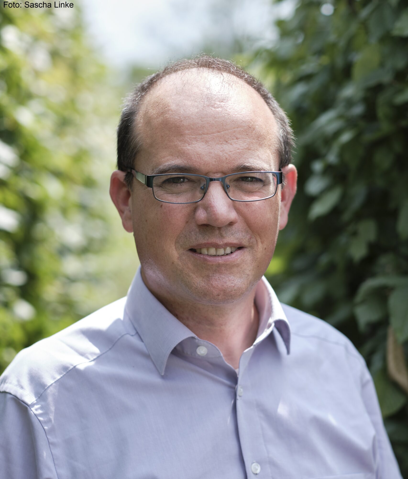
Wissenschaftlicher Werdegang
  • seit 05/2019
    Professur für Geoökologie, Martin-Luther-Universität Halle-Wittenberg
  • 10/2017 – 04/2019
    Vertretungsprofessur Geoökologie, Martin-Luther-Universität Halle-Wittenberg
  • 08/2017 – 09/2017
    Akademischer Oberrat auf Zeit, Julius-Maximilians-Universität Würzburg
  • 07/2017
    Habiliatation zum ThemaRemote sensing and geoanalysis to Support sustainable land and water use in the Aral Sea Basin“
  • 08/2011 – 08/2017
    Juniorprofessur für Geographische Fernerkundung, Julius-Maximilians-Universität Würzburg
  • 01/2007 – 07/2011
    Akademischer Oberrat auf Zeit im Elitenetzwerk Bayern, Masterstudiengang „Global Change Ecology“, Universität Bayreuth, angestellt am Lehrstuhl für Fernerkundung des Geographischen Instituts der Universität Würzburg
  • 06 / 2002-12 / 2006
    Wissenschaftlicher Mitarbeiter des Deutschen Fernerkundungsdatenzentrum (DFD) des DLR in Oberpfaffenhofen, Arbeitsgruppe Fernerkundung am Geographischen Institut der Universität Würzburg
  • 12/2006
    Promotion (Dr. rer. nat) im Rahmen des Projektes „Economic and Ecological Restructuring of Land and Water Use in the Khorezm Region (Uzbekistan): A Pilot Project in Development Research“
  • 04/1995 – 02/2002
    Studiengang Geographie an der Universität Mainz, Ausrichtung: Geoökologie
  • 04/1995 – 06/1997
    Studiengang Mathematik, nach Abschluss des Vordiploms beendet
Aktuelle Projekte

Publikationen


Warning: Undefined property: stdClass::$lastName in /var/www/html/geooeko.geo.uni-halle.de/wp-content/plugins/zotpress/lib/request/request.functions.php on line 166

Deprecated: strtolower(): Passing null to parameter #1 ($string) of type string is deprecated in /var/www/html/geooeko.geo.uni-halle.de/wp-content/plugins/zotpress/lib/request/request.functions.php on line 166
1
Koza, M., Funk, R., Poehlitz, J., Conrad, C., Shibistova, O., Meinel, T., Akshalov, K. and Schmidt, G. (2024) Wind Erosion after Steppe Conversion in Kazakhstan. Soil and Tillage Research, 236, 105941. https://doi.org/10.1016/j.still.2023.105941.
1
El-Hokayem, L., De Vita, P., Usman, M., Link, A. and Conrad, C. (2023, August 30) Potential Groundwater Dependent Vegetation in the Mediterranean [Dataset]. PANGAEA. https://doi.pangaea.de/10.1594/PANGAEA.961765.
1
El-Hokayem, L., De Vita, P., Usman, M., Link, A. and Conrad, C. (2023) Mapping Potentially Groundwater-Dependent Vegetation in the Mediterranean Biome Using Global Geodata Targeting Site Conditions and Vegetation Characteristics. Science of The Total Environment, 898, 166397. https://doi.org/10.1016/j.scitotenv.2023.166397.
1
Link, Andreas, El-Hokayem, L., Usman, M., Conrad, C., Reinecke, R., Berger, M., Wada, Y., Coroama, V. and Finkbeiner, M. (2023, August 3) Groundwater-Dependent Ecosystems at Risk [Dataset]. Mendeley. https://doi.org/10.17632/P39Y3MDH6N.3.
1
Link, A., El-Hokayem, L., Usman, M., Conrad, C., Reinecke, R., Berger, M., Wada, Y., Coroama, V. and Finkbeiner, M. (2023) Groundwater-Dependent Ecosystems at Risk – Global Hotspot Analysis and Implications. Environmental Research Letters. https://doi.org/10.1088/1748-9326/acea97.
1
Tetteh, G.O., Schwieder, M., Erasmi, S., Conrad, C. and Gocht, A. (2023) Comparison of an Optimised Multiresolution Segmentation Approach with Deep Neural Networks for Delineating Agricultural Fields from Sentinel-2 Images. PFG – Journal of Photogrammetry, Remote Sensing and Geoinformation Science. https://doi.org/10.1007/s41064-023-00247-x.
1
El-Hokayem, L., De Vita, P. and Conrad, C. (2023) Local Identification of Groundwater Dependent Vegetation Using High-Resolution Sentinel-2 Data – A Mediterranean Case Study. Ecological Indicators, 146, 109784. https://doi.org/10.1016/j.ecolind.2022.109784.
1
Conrad, C., Schmidt, G. and Kussainova, M. (2023) Current and Potential Conflicts for Ecosystem Services Caused by Agricultural Land Use in Central Asia, and Essential Implications for Research on Sustainable Land Management in the Region. CAJSCR, 2. https://doi.org/https://doi.org/10.29258/CAJSCR/2023-R1.v2-1/1-21.eng.
1
Wenzel, J.L., Conrad, C., Piernicke, T., Spengler, D. and Poehlitz, J. (2022) Assessing the Impact of Different Irrigation Levels on Starch Potato Production. Agronomy, 12, 2685. https://doi.org/10.3390/agronomy12112685.
1
Koza, M., Poehlitz, J., Prays, A., Kaiser, K., Mikutta, R., Conrad, C., Vogel, C., Meinel, T., Akshalov, K. and Schmidt, G. (2022) Potential Erodibility of Semi‐arid Steppe Soils Derived from Aggregate Stability Tests. European Journal of Soil Science. https://doi.org/10.1111/ejss.13304.
1
Schuermann, A., Kleemann, J., Teucher, M., Fürst, C. and Conrad, C. (2022) Migration in West Africa: A Visual Analysis of Motivation, Causes, and Routes. Ecology and Society, 27, art16. https://doi.org/10.5751/ES-13489-270316.
1
Orynbaikyzy, A., Gessner, U. and Conrad, C. (2022) Spatial Transferability of Random Forest Models for Crop Type Classification Using Sentinel-1 and Sentinel-2. Remote Sensing, 14, 1493. https://doi.org/10.3390/rs14061493.
1
Teucher, M., Thürkow, D., Alb, P. and Conrad, C. (2022) Digital In Situ Data Collection in Earth Observation, Monitoring and Agriculture—Progress towards Digital Agriculture. Remote Sensing, 14, 393. https://doi.org/10.3390/rs14020393.
1
Wenzel, J.L., Schmidt, G., Usman, M., Conrad, C. and Volk, M. (2021) Long-Term Baseflow Estimation and Environmental Flow assessment in a Mining-Impacted Catchment in Central Germany. Hercynia N.F., 54, 103–143.
1
Loew, J., Ullmann, T. and Conrad, C. (2021) The Impact of Phenological Developments on Interferometric and Polarimetric Crop Signatures Derived from Sentinel-1: Examples from the DEMMIN Study Site (Germany). Remote Sensing, 13, 2951. https://doi.org/10.3390/rs13152951.
1
Vallentin, C., Harfenmeister, K., Itzerott, S., Kleinschmit, B., Conrad, C. and Spengler, D. (2021) Suitability of Satellite Remote Sensing Data for Yield Estimation in Northeast Germany. Precision Agriculture. https://doi.org/10.1007/s11119-021-09827-6.
1
Koza, M., Schmidt, G., Bondarovich, A., Akshalov, K., Conrad, C. and Poehlitz, J. (2021) Consequences of Chemical Pretreatments in Particle Size Analysis for Modelling Wind Erosion. Geoderma, 396, 115073. https://doi.org/10.1016/j.geoderma.2021.115073.
1
Tetteh, G.O., Gocht, A., Erasmi, S., Schwieder, M. and Conrad, C. (2021) Evaluation of Sentinel-1 and Sentinel-2 Feature Sets for Delineating Agricultural Fields in Heterogeneous Landscapes. IEEE Access, 9, 116702–116719. https://doi.org/10.1109/ACCESS.2021.3105903.
1
Schönbrodt-Stitt, S., Ahmadian, N., Kurtenbach, M., Conrad, C., Romano, N., Bogena, H.R., Vereecken, H. and Nasta, P. (2021) Statistical Exploration of SENTINEL-1 Data, Terrain Parameters, and in-Situ Data for Estimating the Near-Surface Soil Moisture in a Mediterranean Agroecosystem. Frontiers in Water, 3, 75. https://doi.org/10.3389/frwa.2021.655837.
1
Hosseini, M., McNairn, H., Mitchell, S., Robertson, L.D., Davidson, A., Ahmadian, N., Bhattacharya, A., Borg, E., Conrad, C., Dabrowska-Zielinska, K., de Abelleyra, D., Gurdak, R., Kumar, V., Kussul, N., Mandal, D., Rao, Y.S., Saliendra, N., Shelestov, A., Spengler, D., Verón, S.R., Homayouni, S. and Becker-Reshef, I. (2021) A Comparison between Support Vector Machine and Water Cloud Model for Estimating Crop Leaf Area Index. Remote Sensing, 13, 1348. https://doi.org/10.3390/rs13071348.
1
Conrad, C., Usman, M., Morper-Busch, L. and Schönbrodt-Stitt, S. (2020) Remote Sensing-Based Assessments of Land Use, Soil and Vegetation Status, Crop Production and Water Use in Irrigation Systems of the Aral Sea Basin. A Review. Water Security, 11, 100078. https://doi.org/10.1016/j.wasec.2020.100078.
1
Tetteh, G.O., Gocht, A. and Conrad, C. (2020) Optimal Parameters for Delineating Agricultural Parcels from Satellite Images Based on Supervised Bayesian Optimization. Computers and Electronics in Agriculture, 178. https://doi.org/https://doi.org/10.1016/j.compag.2020.105696.
1
Ibrakhimov, M., Awan, U.K., Sultanov, M., Akramkhanov, A., Djumaboev, K., Conrad, C. and Lamers, J. (2020) Combining Remote Sensing and Modeling Approaches to Assess Soil Salinity in Irrigated Areas of the Aral Sea Basin. Central Asian Journal of Water Research, 5, 64–81. https://doi.org/10.29258/CAJWR/2019-R1.v5-2/64-81eng.
1
Remelgado, R., Zaitov, S., Kenjabaev, S., Stulina, G., Sultanov, M., Ibrakhimov, M., Akhmedov, M., Dukhovny, V. and Conrad, C. (2020) A Crop Type Dataset for Consistent Land Cover Classification in Central Asia. https://doi.org/10.1038/s41597-020-00591-2.
1
Usman, M., Qamar, M.U., Becker, R., Zaman, M., Conrad, C. and Salim, S. (2020) Numerical Modelling and Remote Sensing Based Approaches for Investigating Groundwater Dynamics under Changing Land-Use and Climate in the Agricultural Region of Pakistan. Journal of Hydrology, 581, 124408. https://doi.org/10.1016/j.jhydrol.2019.124408.
1
Tetteh, G.O., Gocht, A., Schwieder, M., Erasmi, S. and Conrad, C. (2020) Unsupervised Parameterization for Optimal Segmentation of Agricultural Parcels from Satellite Images in Different Agricultural Landscapes. Remote Sensing, 12, 3096. https://doi.org/10.3390/rs12183096.
1
Orynbaikyzy, A., Gessner, U., Mack, B. and Conrad, C. (2020) Crop Type Classification Using Fusion of Sentinel-1 and Sentinel-2 Data: Assessing the Impact of Feature Selection, Optical Data Availability, and Parcel Sizes on the Accuracies. Remote Sensing, 12, 2779. https://doi.org/10.3390/rs12172779.
1
Usman, M., Mahmood, T., Conrad, C. and Bodla, H.U. (2020) Remote Sensing and Modelling Based Framework for Valuing Irrigation System Efficiency and Steering Indicators of Consumptive Water Use in an Irrigated Region. Sustainability, 12, 9535. https://doi.org/10.3390/su12229535.
1
Kenjabaev, S., Conrad, C., Eshchanov, O., Arifjanov, A., Abduraimova, D. and Voxidova, U. (2020) Comparison of Spectro-Biophysical and Yield Parameters of Cotton in Irrigated Lowlands of Amudaria River. InterCarto. InterGIS, 26, 294–308. https://doi.org/10.35595/2414-9179-2020-3-26-294-308.
1
Dhillon, M.S., Dahms, T., Kuebert-Flock, C., Borg, E., Conrad, C. and Ullmann, T. (2020) Modelling Crop Biomass from Synthetic Remote Sensing Time Series: Example for the DEMMIN Test Site, Germany. Remote Sensing, 12, 1819. https://doi.org/10.3390/rs12111819.
1
Ahmadian, N., Ullmann, T., Verrelst, J., Borg, E., Zölitz, R. and Conrad, C. (2019) Biomass Assessment of Agricultural Crops Using Multi-Temporal Dual-Polarimetric TerraSAR-X Data: A Case Study on Northeast Germany. PFG – Journal of Photogrammetry, Remote Sensing and Geoinformation Science, 87, 159–175. https://doi.org/10.1007/s41064-019-00076-x.
1
Kumar, N., Khamzina, A., Tischbein, B., Knöfel, P., Conrad, C. and Lamers, J.P.A. (2019) Spatio-Temporal Supply–Demand of Surface Water for Agroforestry Planning in Saline Landscape of the Lower Amudarya Basin. Journal of Arid Environments, 162, 53–61. https://doi.org/10.1016/j.jaridenv.2018.11.007.
1
Orynbaikyzy, A., Gessner, U. and Conrad, C. (2019) Crop Type Classification Using a Combination of Optical and Radar Remote Sensing Data: A Review. International Journal of Remote Sensing, 40, 6553–6595. https://doi.org/10.1080/01431161.2019.1569791.
1
Ludwig, M., Ludwig, H., Conrad, C., Dahms, T. and Meyhöfer, R. (2019) Cabbage Whiteflies Colonise Brassica Vegetables Primarily from Distant, Upwind Source Habitats. Entomologia Experimentalis et Applicata, 34, 29. https://doi.org/10.1111/eea.12827.
1
Zoungrana, B.J.-B., Conrad, C., Thiel, M., Amekudzi, L.K. and Da, E.D. (2018) MODIS NDVI Trends and Fractional Land Cover Change for Improved Assessments of Vegetation Degradation in Burkina Faso, West Africa. Journal of Arid Environments, 153, 66–75. https://doi.org/10.1016/j.jaridenv.2018.01.005.
1
Usman, M., Reimann, T., Liedl, R., Abbas, A., Conrad, C. and Saleem, S. (2018) Inverse Parametrization of a Regional Groundwater Flow Model with the Aid of Modelling and GIS: Test and Application of Different Approaches. ISPRS International Journal of Geo-Information, 7, 22. https://doi.org/10.3390/ijgi7010022.
1
Sultanov, M., Ibrakhimov, M., Akramkhanov, A., Bauer, C. and Conrad, C. (2018) Modelling End-of-Season Soil Salinity in Irrigated Agriculture Through Multi-Temporal Optical Remote Sensing, Environmental Parameters, and In Situ Information. PFG – Journal of Photogrammetry, Remote Sensing and Geoinformation Science, 86, 221–233. https://doi.org/10.1007/s41064-019-00062-3.
1
Usman, M., Liedl, R., Arshad, M. and Conrad, C. (2018) 3-D Numerical Modelling of Groundwater Flow for Scenario-Based Analysis and Management. Water SA, 44, 01–09. https://doi.org/10.4314/wsa.v44i2.01.
1
Heinrich, I., Balanzategui, D., Bens, O., Blasch, G., Blume, T., Böttcher, F., Borg, E., Brademann, B., Brauer, A., Conrad, C., Dietze, E., Dräger, N., Fiener, P., Gerke, H.H., Güntner, A., Heine, I., Helle, G., Herbrich, M., Harfenmeister, K., Heußner, K.-U., Hohmann, C., Itzerott, S., Jurasinski, G., Kaiser, K., Kappler, C., Koebsch, F., Liebner, S., Lischeid, G., Merz, B., Missling, K.D., Morgner, M., Pinkerneil, S., Plessen, B., Raab, T., Ruhtz, T., Sachs, T., Sommer, M., Spengler, D., Stender, V., Stüve, P. and Wilken, F. (2018) Interdisciplinary Geo-Ecological Research across Time Scales in the Northeast German Lowland Observatory (TERENO-NE). Vadose Zone Journal, 17, 0. https://doi.org/10.2136/vzj2018.06.0116.
1
Löw, F., Biradar, C., Fliemann, E., Lamers, J.P.A. and Conrad, C. (2017) Assessing Gaps in Irrigated Agricultural Productivity through Satellite Earth Observations—A Case Study of the Fergana Valley, Central Asia. International Journal of Applied Earth Observation and Geoinformation, 59, 118–134. https://doi.org/10.1016/j.jag.2017.02.014.
1
Batsaikhan, A., Asam, S., Klein, D. and Conrad, C. (2017) Analysis of Grassland Phenology at Different Site Conditions Using Webcams-A Case Study in the European Alps-. Journal of the Japan society of photogrammetry and remote sensing, 56, 137–142. https://doi.org/10.4287/jsprs.56.137.
1
Forkuor, G., Conrad, C., Thiel, M., Zoungrana, B.J.-B. and Tondoh, J. (2017) Multiscale Remote Sensing to Map the Spatial Distribution and Extent of Cropland in the Sudanian Savanna of West Africa. Remote Sensing, 9, 839. https://doi.org/10.3390/rs9080839.
1
Conrad, C., Löw, F. and Lamers, J.P.A. (2017) Mapping and Assessing Crop Diversity in the Irrigated Fergana Valley, Uzbekistan. Applied Geography, 86, 102–117. https://doi.org/10.1016/j.apgeog.2017.06.016.
1
Xu, X., Conrad, C. and Doktor, D. (2017) Optimising Phenological Metrics Extraction for Different Crop Types in Germany Using the Moderate Resolution Imaging Spectrometer (MODIS). Remote Sensing, 9, 254. https://doi.org/10.3390/rs9030254.
1
Conrad, C., Schönbrodt-Stitt, S., Löw, F., Sorokin, D. and Paeth, H. (2016) Cropping Intensity in the Aral Sea Basin and Its Dependency from the Runoff Formation 2000–2012. Remote Sensing, 8, 630. https://doi.org/10.3390/rs8080630.
1
Dahms, T., Seissiger, S., Conrad, C. and Borg, E. (2016) MODELLING BIOPHYSICAL PARAMETERS OF MAIZE USING LANDSAT 8 TIME SERIES. The International Archives of the Photogrammetry, Remote Sensing and Spatial Information Sciences, XLI-B2, 171–175. https://doi.org/10.5194/isprs-archives-XLI-B2-171-2016.
1
Conrad, C., Kaiser, B.O. and Lamers, J.P.A. (2016) Quantifying Water Volumes of Small Lakes in the Inner Aral Sea Basin, Central Asia, and Their Potential for Reaching Water and Food Security. Environmental Earth Sciences, 75, 2467. https://doi.org/10.1007/s12665-016-5753-8.
1
Conrad, C., Lamers, J.P.A., Ibragimov, N., Löw, F. and Martius, C. (2016) Analysing Irrigated Crop Rotation Patterns in Arid Uzbekistan by the Means of Remote Sensing: A Case Study on Post-Soviet Agricultural Land Use. Journal of Arid Environments, 124, 150–159. https://doi.org/10.1016/j.jaridenv.2015.08.008.
1
Dahms, T., Seissiger, S., Borg, E., Vajen, H., Fichtelmann, B. and Conrad, C. (2016) Important Variables of a RapidEye Time Series for Modelling Biophysical Parameters of Winter Wheat. Photogrammetrie – Fernerkundung – Geoinformation, 2016, 285–299. https://doi.org/10.1127/pfg/2016/0303.
1
Mahmoud, M.I., Duker, A., Conrad, C., Thiel, M. and Shaba Ahmad, H. (2016) Analysis of Settlement Expansion and Urban Growth Modelling Using Geoinformation for Assessing Potential Impacts of Urbanization on Climate in Abuja City, Nigeria. Remote Sensing, 8, 220. https://doi.org/10.3390/rs8030220.
1
Schönbrodt-Stitt, S., Conrad, C., Dimov, D., Ergashev, I., Löw, F., Morper-Busch, L., Muminov, S., Ruziev, I., Schorcht, G., Solodky, G., Sorokin, A., Sorokin, D., Stulina, G., Toshpulatov, R., Zaitov, S., Kitapbayev, A. and Unger-Shayesteh, K. (2018) The WUEMoCA Tool for Monitoring Irrigated Cropland Use and Water Use Efficiency at the Landscape Level of the Aral Sea Basin. In: FSBSI “Pryanishnikov Institute of Agrochemistry,” Ed., Novel Methods and Results of Landscape Research in Europe, Central Asia and Siberia, Vol. 4 Optimising Agricultural Landscapes, Moscow, 351–356.
1
Conrad, C. (2017) Remote Sensing and Geoanalysis to Support Sustainable Land and Water Use in the Aral Sea Basin. Habilitationsschrift, Universität Würzburg.
1
Fritsch, S., Conrad, C., Dürbeck, T. and Schorcht, G. (2014) 3.6 Mapping Marginal Land in Khorezm Using GIS and Remote Sensing Techniques. In: Lamers, J.P., Khamzina, A., Rudenko, I. and Vlek, P.L.G., Eds., Restructuring Land Allocation, Water Use and Agricultural Value Chains: Technologies, Policies and Practices for the Lower Amudarya Region, 1. Auflage., V & R Unipress Bonn University Press, Göttingen, 167–178. https://doi.org/10.14220/9783737002974.167.
1
Forkuor, G., Conrad, C., Landmann, T., Thiel, M. and Zoungrana, E. (2013) Improving Agricultural Land Use Mapping in West Africa Using Multi-Temporal Landsat and RapidEye Data. In: Borg, E. and Daedolow, H., Eds., From the Basics to the Service: Proceedings of the 5th RESA Workshop ; Neustrelitz, 20. – 21. March 2013, DLR, GITO-Verl., Berlin.
1
Conrad, C., Fritsch, S., Lex, S., Löw, F., Rücker, G.R., Schorcht, G., Sultanov, M. and Lamers, J.P.A. (2012) Potenziale Des Red Edge Kanals von RapidEye Zur Unterscheidung Und Zum Monitoring Landwirtschaftlicher Anbaufrüchte Am Beispiel Des Usbekischen Bewässerungssystems Khorezm. In: Borg, E. and Daedolow, H., Eds., From the Basics to the Service: Erste Ergebnisse 4. RESA Workshop, GITO-Verl., Berlin.
1
Conrad, C., Schorcht, G., Tischbein, B., Davletov, S., Sultonov, M. and Lamers, J.P.A. (2012) Agro-Meteorological Trends of Recent Climate Development in Khorezm and Implications for Crop Production. In: Martius, C., Rudenko, I., Lamers, J.P.A. and Vlek, P.L.G., Eds., Cotton, Water, Salts and Soums: Economic and Ecological Restructuring in Khorezm, Uzbekistan, Springer Science+Business Media B.V, Dordrecht, 25–36. https://doi.org/10.1007/978-94-007-1963-7_2.
1
Tischbein, B., Awan, U.K., Abdullaev, I., Bobojonov, I., Conrad, C., Jabborov, H., Forkutsa, I., Ibrakhimov, M. and Poluasheva, G. (2012) Water Management in Khorezm: Current Situation and Options for Improvement (Hydrological Perspective). In: Martius, C., Rudenko, I., Lamers, J.P.A. and Vlek, P.L.G., Eds., Cotton, Water, Salts and Soums: Economic and Ecological Restructuring in Khorezm, Uzbekistan, Springer Science+Business Media B.V, Dordrecht, 69–92. https://doi.org/10.1007/978-94-007-1963-7_5.
1
Feilhauer, H., Stenzel, S., Kübert, C., Metz, A., Conrad, C., Ehlers, M., Esch, T., Klein, D., Oldenburg, C., Reinartz, P. and Schmidtlein, S. (2012) RapidEye Im Projekt MSAVE – Multisaisonale Fernerkundung Für Das Vegetationsmonitoring. In: Borg, E., Daedolow, H. and Johnson, R., Eds., Vom Algorithmus Zum Produkt: Tagungsband Zum 4. RESA Workshop, Neustrelitz, 21. – 22. März 2012, Orangerie Neustrelitz ; [RapidEye Science Archive (RESA), GITO, Berlin, 153–164.
1
Ruecker, G., Conrad, C., Ibragimov, N., Kienzler, K., Ibrakhimov, M., Martius, C. and Lamers, J.P.A. (2012) Spatial Distribution of Cotton Yield and Its Relationship to Environmental, Irrigation Infrastructure and Water Management Factors on a Regional Scale in Khorezm, Uzbekistan. In: Martius, C., Rudenko, I., Lamers, J.P.A. and Vlek, P.L.G., Eds., Cotton, Water, Salts and Soums: Economic and Ecological Restructuring in Khorezm, Uzbekistan, Springer Science+Business Media B.V, Dordrecht, 59–68. https://doi.org/10.1007/978-94-007-1963-7_4.
1
Fritsch, S., Conrad, C. and Dech, S.W. (2011) Einsatz Multitemporaler RapidEye-Daten Zur Feldbasierten Ableitung von FPAR Und Landnutzung in Einer Zentralasiatischen Bewässerungsregion. In: Borg, E. and Daedolow, H., Eds., RapidEye Science Archive (RESA) – Erste Ergebnisse: 3. RESA Workshop ; Tagungsband Zum 3. RESA Workshop, Neustrelitz, 23. – 24. März 2011, Orangerie Neustrelitz, GITO, Berlin.
1
Schorcht, G., Conrad, C., Fritsch, S. and Lamers, J.P.A. (2011) Space-Support to Improve Land and Water Management on the Ground. https://www.zef.de/fileadmin/webfiles/downloads/projects/khorezm/downloads/Publications/ZUR/ZUR-No23.pdf.
1
Awan, U.K., Tischbein, B., Conrad, C., Sultanov, M. and Lamers, J.P.A. (2011) Irrigation and Drainage Systems in Khorezm, Uzbekistan. https://www.zef.de/fileadmin/webfiles/downloads/projects/khorezm/downloads/Publications/wps/WP12_Awan.pdf.
1
Fritsch, S., Conrad, C., Schorcht, G. and Manschadi, A.M. (2011) Calculating Crop Yields from Space. https://www.zef.de/fileadmin/webfiles/downloads/projects/khorezm/downloads/Publications/ZUR/ZUR-No19.pdf.
1
Conrad, C., Schorcht, G., Fritsch, S. and Zeidler, J. (2010) How Satellite Images Can Improve Agricultural Land and Water Management. https://www.zef.de/fileadmin/webfiles/downloads/projects/khorezm/downloads/Publications/ZUR/ZUR-No11.pdf.
1
Conrad, C., Rücker, G.R., Mund, J.-P., Schmidt, M. and Mehl, H. (2010) Beiträge Der Satellitenfernerkundung Für Ein Nachhaltiges Und Grenzüberschreitendes Wassermanagement in Zentralasien. In: Kramer, M., Ed., Studien Zum Internationalen Umweltmanagement.: Kooperationspotenziale Zwischen Deutschland Und Zentralasien, Gabler Verlag / Springer Fachmedien Wiesbaden GmbH Wiesbaden, Wiesbaden, 254–266.
1
Giriraj, A., Joshi, P.K., Barbar, Shilpa., Wegmann, M., Conrad, C., Sudhakar, S. and Beierkuhnlein, C. (2009) Systematic Assessment of Forest Cover Change and Forest Fragmentation in Indian Sub-Continent Using Multi-Scale Satellite Remote Sensing Inputs. In: Joshi, P.K., Ed., Geoinformatics for Natural Resource Management, Nova Science Publishers, New York, 185–213.
1
Colditz, R.R., Conrad, C., Wehrmann, T., Schmidt, M. and Dech, S.W. (2009) Analysis of the Quality of Collection 4 and 5 Vegetation Index Time Series from MODIS. In: Stein, A., Shi, W. and Bijker, W., Eds., Quality Aspects in Spatial Data Mining: International Symposium on Spatial Data Quality ; 5th Symposium, ISSDQ 2007, in Enschede, The Netherlands ; Best Papers, CRC Press, Boca Raton, Fla.
1
Siefker, U., Conrad, C. and Dech, S.W. (2006) Kuwait Aus Dem Weltall – Anwendungsmöglichkeiten von Fernerkundung Im Stadtstaat Am Inneren Golf. Die Beziehungen Zwischen Der Bundesrepublik Deutschland Und Dem Staat Kuwait – Historische Perspektiven Und Geographische Analysen Mit GIS Des Energiezentrums Am Oberen Golf., Würzburg, 77–100. https://www.geographie.uni-wuerzburg.de/fileadmin/09010000/WR_vortragsSchriftenreihen/wgm/WGM_SH9_Kuwait_Inhalt_Einleitung_1_.pdf.
1
Rücker, G.R., Conrad, C., Colditz, R.R., Strunz, G. and Dech, S.W. (2005) Remote Sensing Based Mapping and Characterization of Soil and Vegetation Quality of Potential Plantation Areas in the Desiccated Aral Sea Area. https://www.zef.de/fileadmin/webfiles/downloads/projects/khorezm/downloads/Publications/wps/ZEF-UZ-WP07-Ruecker2.pdf.
1
Rücker, G.R. and Conrad, C. (2003) Exploring Leaf Area Index Development and Land Cover Classification in the Lower Amu Darya Basin in Uzbekistan Based on Multi-Temporal and Multi-Spatial Remote Sensing Data. https://www.zef.de/fileadmin/webfiles/downloads/projects/khorezm/downloads/Publications/wps/ZEF-UZ-WP05-Ruecker.pdf.

Warning: Undefined property: stdClass::$lastName in /var/www/html/geooeko.geo.uni-halle.de/wp-content/plugins/zotpress/lib/request/request.functions.php on line 166

Deprecated: strtolower(): Passing null to parameter #1 ($string) of type string is deprecated in /var/www/html/geooeko.geo.uni-halle.de/wp-content/plugins/zotpress/lib/request/request.functions.php on line 166
1
Friedrich, C., Loew, J., Otte, I., Hill, S., Förtsch, S., Schwalb-Willmann, J., Gessner, U., Schierghofer, C., Piernecke, T., Truckenbrodt, S., Schonert, E., Assmann, D., Böttcher, F., Conrad, C. and Thiel, M. (2024, February 28) A Multi-Talented Datacube: Integrating, Processing and Presenting Big Geodata for the agricultural End User. Stuttgart-Hohenheim.
1
Friedrich, C., Loew, J., Otte, I., Hill, S., Förtsch, S., Schwalb-Willmann, J., Gessner, U., Schierghofer, C., Piernecke, T., Truckenbrodt, S., Schonert, E., Assmann, D., Böttcher, F., Conrad, C. and Thiel, M. (2024) A Multi-Talented Datacube: Integrating, Processing and Presenting Big Geodata for the agricultural End User. Informatik in Der Land-, Forstund: Biodiversität Fördern Durch Digitale Landwirtschaft, Stuttgart-Hohenheim.
1
Wenzel, J.L., Conrad, C. and Poehlitz, J. (2024) Soil Moisture Simulations for a Sustainable Irrigation Management. C. Hoffmann, A. Stein, E. Gallmann, J. Dörr, C. Krupitzer, H. Floto (Hrsg.) Informatik in Der Land-, Forst- Und Ernährungswirtschaft: Biodiversität Fördern Durch Digitale Landwirtschaft, GI Lecture Notes in Informatics (LNI), Stuttgart-Hohenheim, 449–453.
1
Conrad, C., Schlaak, J., Schmelzer, J. and Loew, J. (2023) Downscaling and Validation of 1km ESA Soil Water Index for Soil Moisture Monitoring on Agricultural Land in Temperate Climate Conditions. EGU, Naples. https://doi.org/https://doi.org/10.5194/egusphere-gc8-hydro-97, 2023.
1
Koenig, L., Teucher, M., Ziegler, K., Abel, D., Weber, T., Paeth, H. and Conrad, C. (2022, September 12) Development of a Web Based Decision Support System to Provide Climate Data and Relevant Indicators for Climate Change Adaption. https://rgdoi.net/10.13140/RG.2.2.32472.98560.
1
Spengler, D., Asam, S., Boettcher, F., Borg, E., Dobers, E.S., Geßner, U., Harfenmeister, K., Hüttich, C., Klan, F., Teucher, M., Truckenbrodt, S. and Conrad, C. (2021) AgriSens – DEMMIN 4.0. Meyer-Aurich, A., Gandorfer, M., Hoffmann, C., Weltzien, C., Bellingrath-Kimura, S. & Floto, H. (Hrsg.) – Gesellschaft für Informatik e.V., Bonn, 415–420. https://dl.gi.de/handle/20.500.12116/35712.
1
Bayat, A.T., Schonbrodt-Stitt, S., Nasta, P., Ahmadian, N., Conrad, C., Bogena, H.R., Vereecken, H., Jakobi, J., Baatz, R. and Romano, N. (2020) Mapping Near-Surface Soil Moisture in a Mediterranean Agroforestry Ecosystem Using Cosmic-Ray Neutron Probe and Sentinel-1 Data. 2020 IEEE International Workshop on Metrology for Agriculture and Forestry (MetroAgriFor), IEEE, Trento, Italy, 201–206. https://doi.org/10.1109/MetroAgriFor50201.2020.9277557.
1
Nasta, P., Schonbrodt-Stitt, S., Bogena, H., Kurtenbach, M., Ahmadian, N., Vereecken, H., Conrad, C. and Romano, N. (2019) Integrating Ground-Based and Remote Sensing-Based Monitoring of near-Surface Soil Moisture in a Mediterranean Environment. 2019 IEEE International Workshop on Metrology for Agriculture and Forestry (MetroAgriFor), IEEE, Portici, Italy, 274–279. https://doi.org/10.1109/MetroAgriFor.2019.8909226.
1
Usman, M., Mahmood, T. and Conrad, C. (2019) Performance Assessment of Human Controlled Irrigation System in the Semi-Arid Punjab of Pakistan. https://ui.adsabs.harvard.edu/abs/2019AGUFM.H31L1895U/abstract.
1
Dimov, D., Low, F., Ibrakhimov, M., Sarah-Schonbrodt-Stitt and Conrad, C. (2017) Feature Extraction and Machine Learning for the Classification of Active Cropland in the Aral Sea Basin. 2017 IEEE International Geoscience and Remote Sensing Symposium (IGARSS), IEEE, Fort Worth, TX, 1804–1807. https://doi.org/10.1109/IGARSS.2017.8127326.
1
Dimov, D., Low, F., Ibrakhimov, M., Stulina, G. and Conrad, C. (2017) SAR and Optical Time Series for Crop Classification. 2017 IEEE International Geoscience and Remote Sensing Symposium (IGARSS), IEEE, Fort Worth, TX, 811–814. https://doi.org/10.1109/IGARSS.2017.8127076.
1
Dahms, T., Conrad, C., Kumar-Babu, D., Schmidt, M. and Borg, E. (2017) Derivation of Biophysical Parameters from Fused Remote Sensing Data. 2017 IEEE International Geoscience and Remote Sensing Symposium (IGARSS), IEEE, Fort Worth, TX, 4374–4377. https://doi.org/10.1109/IGARSS.2017.8127970.
1
Gläesser, C., Gerstmann, H., Conrad, C. and Knoefel, P. (2017) Optimization of Multi-Temporal Land Use Classification by Integration of Phenological Time Frames. Brugge, Belgium. https://www.researchgate.net/publication/324170273_Optimization_of_multi-temporal_Land_Use_Classification_by_Integration_of_Phenological_time_frames.
1
Batsaikhan, A., Conrad, C., Asam, S. and Klein, D. (2017) Analyzing the Impact of Snowmelt Timing on Grassland Green-up Dates in the European Alps Using Webcams. Yamaguchi, Japan, 45–46. https://doi.org/NCID:AN00351250.
1
Kaufmann, C., Schmidt, M., Dhams, T., Conrad, C. and Kumar-Babu, D. (2017) Semi-Autonomous Remote Sensing Time Series Generation Tool. In: Bruzzone, L., Bovolo, F. and Benediktsson, J.A., Eds., Image and Signal Processing for Remote Sensing XXIII, SPIE, Warsaw, Poland, 12. https://doi.org/10.1117/12.2278213.
1
Kumar-Babu, D., Kaufmann, C., Schmidt, M., Dahms, T. and Conrad, C. (2017) Autonomous Time Series Generation of High Spatial Resolution Images – A Feasibility Study. Adelaide, Australien, 1–7. https://elib.dlr.de/115667/.
1
Conrad, C., Schönbrodt-Stitt, S., Abdullaev, I., Dimov, D., Ibrakhimov, M., Knoefel, P., Leinich, M., Morper-Busch, L., Schorcht, G., Solodky, G., Sorokin, A., Sorokin, D., Stulina, G., Toshpulatov, R., Unger-Shayesteh, K., Zaitov, S. and Dukhovny, V. (2016) Remote Sensing and GIS for Supporting the Agricultural Use of Land and Water Resources in the Aral Sea Basin. Almaty, Kazakhstan, 111–121. https://www.researchgate.net/publication/308746962_Remote_Sensing_and_GIS_for_Supporting_the_Agricultural_Use_of_Land_and_Water_Resources_in_the_Aral_Sea_Basin.
1
Dimov, D., Kuhn, J. and Conrad, C. (2016) Assessment of Cropping System Diversity in the Fergana Valley through Image Fusion of LANDSAT 8 and SENTINEL-1. Prague, Czech Republic. https://www.researchgate.net/publication/299845462_Assessment_of_cropping_system_diversity_in_the_Fergana_Valley_through_image_fusion_of_LANDSAT_8_and_SENTINEL-1.
1
Lex, S., Dahms, T., Zellner, P., Fritsch, S., Conrad, C. and Schmidt, M. (2015) Generation and Evaluation of Time Series for the Derivation of Biophysical Parameters as an Input for a Crop Model. Bonn. https://elib.dlr.de/96826/.
1
Kübert, C., Conrad, C., Klein, D. and Dech, S. (2013) Land Surface Phenology from MODIS Data in Germany. MultiTemp 2013: 7th International Workshop on the Analysis of Multi-Temporal Remote Sensing Images, IEEE, Banff, AB, 1–4. https://doi.org/10.1109/Multi-Temp.2013.6866015.
1
Forkour, G., Conrad, C., Thiel, M. and Zeidler, J. (2013) Improving Crop Area Estimation in West Africa Using Multiresolution Satellite Data.
1
Dietz, A.J., Künzer, C. and Conrad, C. (2013) Snow Cover Development in Central Asia Derived from Daily, Medium Resolution Remote Sensing Data between 1986 and 2012. Huntsville, Ontario, Canada. https://elib.dlr.de/82818/.
1
Shahabfar, A., Reinwand, M., Conrad, C. and Schorcht, G. (2012) A Re-Examination of Perpendicular Drought Indices over Central and Southwest Asia. Remote Sensing for Agriculture, Ecosystems, and Hydrology XIV, SPIE, 406–415. https://doi.org/10.1117/12.974561.
1
Löw, F., Schorcht, G., Michel, U., Dech, S. and Conrad, C. (2012) Per-Field Crop Classification in Irrigated Agricultural Regions in Middle Asia Using Random Forest and Support Vector Machine Ensemble. In: Michel, U., Civco, D.L., Ehlers, M., Schulz, K., Nikolakopoulos, K.G., Habib, S., Messinger, D. and Maltese, A., Eds., Edinburgh, United Kingdom, 85380R. https://doi.org/10.1117/12.974588.
1
Forkour, G., Landmann, T., Conrad, C. and Dech, S. (2012) Agricultural Land Use Mapping in the Sudanian Savanna of West Africa: Current Status and Future Possibilities. Munich, Germany, 6293–6296. https://doi.org/10.1109/IGARSS.2012.6352698.
1
Dubovyk, O., Menz, G., Conrad, C., Khamzina, A. and Dech, S. (2012) Object-Based Cropland Degradation Identification: A Case in Uzbekistan. Proceedings of SPIE, Edinburgh. https://elib.dlr.de/79205/.
1
Conrad, C., Löw, F., Rudloff, M. and Schorcht, G. (2012) Assessing Irrigated Cropland Dynamics in Central Asia between 2001 and 2010 Based on MODIS Time Series. https://www.researchgate.net/publication/259896412_Assessing_irrigated_cropland_dynamics_in_central_Asia_between_2001_and_2010_based_on_MODIS_time_series.
1
Schorcht, G., Löw, F., Fritsch, S. and Conrad, C. (2012) Crop Classification at Subfield Level Using RapidEye Time Series and Graph Theory Algorithms. In: Neale, C.M.U. and Maltese, A., Eds., Edinburgh, United Kingdom, 85311G. https://doi.org/10.1117/12.974670.
1
Dietz, A., Conrad, C. and Kuenzer, C. (2012) Snow Cover Variability in Central Asia during the Last Decade Derived from MODIS. Cologne, Germany. https://www.researchgate.net/publication/240902630_Snow_cover_variability_in_Central_Asia_during_the_last_decade_derived_from_MODIS.
1
Löw, F., Michel, U., Dech, S. and Conrad, C. (2011) Development of a Satellite-Based Multi-Scale Land Use Classification System for Land and Water Management in Uzbekistan and Kazakhstan. In: Michel, U. and Civco, D.L., Eds., Prague, Czech Republic, 81811K. https://doi.org/10.1117/12.898038.
1
Fritsch, S., Machwitz, M., Conrad, C. and Dech, S. (2011) Relationships between High Resolution RapidEye Based FPAR and MODIS Vegetation Indices in a Heterogeneous Agricultural Region. In: Neale, C.M.U. and Maltese, A., Eds., Prague, Czech Republic, 81740N. https://doi.org/10.1117/12.898333.
1
Conrad, C., Machwitz, M., Schorcht, G., Löw, F., Fritsch, S. and Dech, S. (2011) Potentials of RapidEye Time Series for Improved Classification of Crop Rotations in Heterogeneous Agricultural Landscapes: Experiences from Irrigation Systems in Central Asia. Remote Sensing for Agriculture, Ecosystems, and Hydrology XIII, SPIE, 340–348. https://doi.org/10.1117/12.898345.
1
Machwitz, M., Wegmann, M., Conrad, C. and Dech, S. (2011) Remote Sensing Based Estimation of Potential Terrestrial Carbon Stocks in West Africa. Sydney, Australia.
1
Dubovyk, O., Khamzina, A., Conrad, C. and Menz, G. (2011) Mapping Cropland Marginalisation in the Downstream of the Amu Darya River, Uzbekistan. Bonn. https://www.tropentag.de/2011/abstract.php?code=sTbEMfjQ.
1
Bohovic, R., Klein, D. and Conrad, C. (2011) Phenological Patterns in Central Asia : Monitoring Vegetation Dynamics Using Remote Sensing at Different Scales. Prague, Czech Republic. https://www.researchgate.net/publication/235435834_Phenological_Patterns_in_Central_Asia_Monitoring_Vegetation_Dynamics_Using_Remote_Sensing_at_Different_Scales.
1
Fritsch, S., Conrad, C. and Dech, S. (2010) A MODIS- Based Approach for Crop Yield Prediction in Irrigation Regions of Central Asia Using Light Use Efficiency Modeling. Bergen, Norway.
1
Ehammer, A., Fritsch, S., Conrad, C., Lamers, J. and Dech, S. (2010) Statistical Derivation of FPAR and LAI for Irrigated Cotton and Rice in Arid Uzbekistan by Combining Multi-Temporal RapidEye Data and Ground Measurements. In: Neale, C.M.U. and Maltese, A., Eds., Toulouse, France, 782409. https://doi.org/10.1117/12.864796.
1
Conrad, C., Goessl, A., Lex, S., Metz, A., Esch, T., Konrad, C., Goettlicher, G. and Dech, S. (2010) Mapping Crop Distribution in Administrative Districts of Southwest Germany Using Multi-Sensor Remote Sensing Data. In: Neale, C.M.U. and Maltese, A., Eds., Toulouse, France, 78240C. https://doi.org/10.1117/12.865113.
1
Asam, S., Klein, D., Gessner, U., Conrad, C., Beierkuhnlein, C. and Dech, S. (2010) Ableitung Des Vegetationsbedeckungsgrades Aus Multiskaligen Fernerkundungsdaten Für Hydrologische Modellierung in Zentralasien. Angewandte Geoinformatik 2010. Beiträge Zum 22. AGIT-Symposium Salzburg, Salzburg, Austria, 284–289. https://elib.dlr.de/67181/.
1
Ruecker, G., Wehrmann, T., Schettler, I., Conrad, C., Landmann, T., Klein, D., Fritsch, S., Schorcht, G., Mund, J.P., Kuenzer, C., Keil, M., Mehl, H. and Dech, S. (2009) Integration of Remote Sensing Products in Regional Information Systems to Support Decision Making in Land and Water Management in Central Asia. Proceedings of the 3rd GISCA 2009, Bishkek, Kyrgyzstan. https://elib.dlr.de/72574/.
1
Schorcht, G., Conrad, C., Dech, S., Lamers, J., Rücker, G. and Fritsch, S. (2009) Field Based FAO-56 Dual Crop Coefficient Method for Water Demand Estimations Using Remote Sensing and Geodata Management Approaches. Proceedings of the 3rd GISCA 2009, Bishkek, Kyrgyzstan.
1
Gessner, U., Klein, D., Conrad, C., Schmidt, M. and Dech, S. (2009) Towards an Automated Estimation of Vegetation Cover Fractions on Multiple Scales: Examples of Eastern and Southern Africa. Stresa, Italy.
1
Conrad, C., Falk, U., Hendricks, J. and Stefan, D. (2009) Modelling Surface Energy Fluxes Based on Multitemporal Remote Sensing Data at Different Scales. Stresa, Italy. https://www.researchgate.net/publication/225023288_Modelling_surface_energy_fluxes_based_on_multitemporal_remote_sensing_data_at_different_scales/citations.
1
Colditz, R., Cord, A., Conrad, C., Franz, M., Pedro, M. and Ressl, R. (2009) Analyzing Phenological Characteristics of Mexico with MODIS Time Series Products. Mystic, Connecticut, USA, 1–7. https://elib.dlr.de/60624/.
1
Machwitz, M., Landmann, T., Conrad, C., Cord, A. and Dech, S. (2008) Land Cover Analysis on Sub-Continental Scale: FAO LCCS Standard with 250 Meter MODIS Satellite Observations in West Africa. Boston, Massachusetts, USA, 49–52. https://doi.org/10.1109/IGARSS.2008.4780024.
1
Geßner, U., Conrad, C., Hüttich, C., Keil, M., Schmidt, M., Schramm, M. and Dech, S. (2008) A Multi-Scale Approach for Retrieving Proportional Cover of Life Forms. Boston, Massachusetts, USA.
1
Fritsch, S., Conrad, C., Rücker, G. and Dech, S. (2008) Objektbasierte Klassifikation Der Agrarischen Landnutzung Im Gebiet Khorezm (Usbekistan). Salzburg, Austria, 550–555. https://www.researchgate.net/publication/225000597_Objektbasierte_Klassifikation_der_agrarischen_Landnutzung_im_Gebiet_Khorezm_Usbekistan.
1
Esch, T., Conrad, C., Schorcht, G., Thiel, M., Wehrmann, T. and Dech, S. (2008) Model-Based Estimation of Impervious Surface by Application of Support Vector Machines. Proceedings of ISPRS 2008 Congress, Beijing, China, 41–45. https://elib.dlr.de/57593/.
1
Eshchanov, R., Conrad, C. and Lamers, J.P.A. (2007) Using Remote Sensing to Monitor the Cotton Growth in the Khorezm Region. Tashkent, Uzbekistan, 210–213.
1
Conrad, C., Colditz, R., Dech, S. and Vlek, P. (2007) Combining Temporal Segmentation and Classification Trees for Time Series Classification. Leuven, Belgium.
1
Loew, J., Hill, S., Thiel, M., Ullmann, T. and Conrad, C. (2024, June 20) How Does Phenology Shape Crop- And Orbit-Specific InSAR Coherence And PolSAR-Signatures Of Sentinel-1. Manchester, UK.
1
Friedrich, C., Loew, J., Otte, I., Hill, S., Schierghofer, C., Gessner, U., Truckenbrodt, S., Schonert, E., Piernecke, T., Conrad, C. and Thiel, M. (2024, March 21) DataCube Architecture for Integrating, Processing and Presenting Big Geodata to End Users. Berlin.
1
Loew, J., Hill, S., Thiel, M., Ullmann, T. and Conrad, C. (2024, March 15) Tracking Crop Phenology across Different Sentinel-1 Orbits by Combining PolSAR Features with Growing Degree Data. Remagen.
1
Loew, J., Hill, S., Thiel, M., Ullmann, T. and Conrad, C. (2024) Tracking Crop Phenology across Different Sentinel-1 Orbits by Combining PolSAR Features with Growing Degree Data. Remagen.
1
Poehlitz, J., Wenzel, J.L., Piernicke, T., Teucher, M., Gerighausen, H., Gessner, U., Thiel, M., Kunz, M. and Conrad, C. (2024, February 27) AgriSens – Demmin 4.0: Digital Solutions for Sustainable Agriculture through Remote Technologies (Phase II). Poster, Stuttgart-Hohenheim.
1
Wenzel, J.L., Conrad, C. and Poehlitz, J. (2024, February 27) Soil Moisture Simulations for a Sustainable Irrigation Management. Poster, Stuttgart-Hohenheim.
1
Koza, M. (2024, February 2) Quantifying Wind Erosion in the Cultivated Steppe of Kazakhstan. Kloster Schöntal, Germany.
1
Schuermann, A., Kleemann, J., Teucher, M. and Conrad, C. (2023) Finding the Hotspots: A Novel Geo-Spatial Approach to Identify Areas in Ghana That Are Prone to Internal Migration. Deutscher Kongress für Geographie 2023, Frankfurt (Main).
1
Schuermann, A., Conrad, C. and Kleemann, J. (2023) Assessing Different Climate Migration Frameworks and Its Applicability to Rural Migration in Ghana. Deutscher Kongress für Geographie 2023, Frankfurt (Main).
1
Lepore, D., Conrad, C., Allocca, V., Cusano, D., Loew, J., El-Hokayem, L. and De Vita, P. (2023) Integration of Remotely Sensed and Field Monitoring Data for Characterizing the Hydrological Regime of Soils Covering Karst Aquifers and Assessing Groundwater Recharge. EGU, Naples. https://doi.org/https://doi.org/10.5194/egusphere-gc8-hydro-65, 2023.
1
Wenzel, J.L., Conrad, C., Piernicke, T., Haßelbusch, K., Boettcher, F. and Poehlitz, J. (2023, June 14) Observing Soil Moisture Dynamics on Starch Potato Fields for Improving Irrigation Management Based on Hydrological Simulations. Poster, Naples, Italy.
1
Conrad, C., Schlaak, J., Schmelzer, J. and Loew, J. (2023) Downscaling and Validation of 1km ESA Soil Water Index for Soil Moisture Monitoring on Agricultural Land in Temperate Climate Conditions. EGU, Naples. https://doi.org/https://doi.org/10.5194/egusphere-gc8-hydro-97, 2023.
1
Schuermann, A., Kleemann, J., Teucher, M. and Conrad, C. (2023) Using a Multifactorial Overlay Approach to Identify Hotspots of Environment-Induced Migration  in Three West African Countries. Cologne.
1
Wenzel, J.L., Conrad, C., Piernicke, T. and Poehlitz, J. (2023, May 15) Modeling Soil Moisture dynamics on Variably Irrigated Starch Fields. Oral Presentation, Berlin, Germany.
1
El-Hokayem, L., De Vita, P. and Conrad, C. (2023) Mapping of Potential Groundwater Dependent Vegetation Zones in the Mediterranean Using a Simple Index Based on Global-Available Geodata and High-Resolution Remote Sensing. EGU, Naples. https://doi.org/https://doi.org/10.5194/egusphere-gc8-hydro-61.
1
Koenig, L., Teucher, M., Ziegler, K., Abel, D., Weber, T., Paeth, H. and Conrad, C. (2023) Development of a Web Based Decision Support System to Provide Relevant Climate Indicators for Climate Change Adaption. other, oral. https://doi.org/10.5194/egusphere-egu23-12019.
1
Schuermann, A., Conrad, C. and Kleemann, J. (2022) Exploring the Food-Climate-Migration Nexus in West Africa by Analyzing Land Surface Dynamics and Weather Extremes in Combination with Expert Interviews. 2nd International Conference on Geographical Science for Resilient Communities, Ecosystems and Livelihoods under Global Environmental Change. Kampala, Uganda ​​​.
1
Wenzel, J.L., Piernicke, T., Poehlitz, J., Haßelbusch, K., Böttcher, F., Spengler, D. and Conrad, C. (2022, October 12) Using Soil Hydraulic Properties for an Efficient Starch Potato Irrigation Management. Oral Presentation, Nanjing, China.
1
Loew, J., Hill, S., Ullmann, T. and Conrad, C. (2022) Assessing the Applicability of Interferometric and Polarimetric Time Series Derived from Sentinel-1 for Tracking Phenological Developments of Crops at the JECAM Site DEMMIN (Germany). Arbeitskreis Fernerkundung, Halle (Saale).
1
Wenzel, J.L., Piernicke, T., Böttcher, F., Spengler, D., Conrad, C. and Poehlitz, J. (2022, September 1) Economic Effects of Variable Irrigation on Yield and Quality Parameters of High-Amylopectin Potatoes. Poster, Potsdam, Germany.
1
Thürkow, F., Conrad, C., Thürkow, D. and Teucher, M. (2022, May 26) Suitability of Thermal UAV Data to Detect Stones and Artificial Objects in Agriculture. Bonn.
1
Teucher, M., Conrad, C., Alb, P. and Thürkow, D. (2022, May 25) Provision of FAIR In-Situ Data for Calibration and Validation in RS Precision Agriculture. Bonn.
1
Loew, J., Hill, S., Ullmann, T. and Conrad, C. (2022) Tracking the Phenological Developments of Crops by a Complementary Set of Interferometric and Polarimetric Time Series Derived from Sentinel-1 at the JECAM Site DEMMIN (Germany). ESA Living Planet Symposium, Bonn.
1
Schuermann, A. and Conrad, C. (2022) Analyzing Land Surface Dynamics and Weather Extremes Combined with Qualitative Field Research to Disentangle the Food-Climate-Migration Nexus in West Africa. ESA Living Planet Symposium. Bonn.
1
Spengler, D., Böttcher, F., Borg, E., Dobers, E.S., Gerighausen, H., Klan, F., Otte, I., Teucher, M., Thiel, M., Truckenbrodt, S., Wenzl, M. and Conrad, C. (2022, May 23) Pathways to Using Remote Sensing in Crop Cultivation and Management – the German Digital Test Field AgriSens DEMMIN 4.0. Bonn.
1
Nußbaum, P., Somogyvári, M., Bresinsky, L., Loew, J., Schönbrodt-Stitt, S., Sauter, M., Conrad, C. and Engelhardt, I. (2020) Vulnerability Assessment of Karst Aquifers under Mediterranean Climates. other, oral. https://doi.org/10.5194/egusphere-egu2020-5112.
1
Wenzel, J.L., Poehlitz, J. and Conrad, C. (2023, December 6) Digitale Abschätzung Des Bewässerungsbedarfs Im Kartoffelanbau- Bodenfeuchtesimulationen Und Ertragsschätzung. Oral Presentation, Halle.
1
Wenzel, J.L., Loew, J., Poehlitz, J. and Conrad, C. (2023, November 17) Neues von Oben – Aktuelle Entwicklungen Satelliten- Und Drohnenbasierter Digitalisierung Im Pflanzenbau. Oral Presentation, Hannover, Germany.
1
Itzerott, S., Hohmann, C., Stender, V., Maass, H., Borg, E., Renke, F., Jahncke, D., Berg, M., Conrad, C. and Spengler, D. (2018) TERENO (Northeast), Soil Moisture Stations of the GFZ German Research Centre for Geoscienes (GFZ). GFZ Data Services. https://doi.org/10.5880/TERENO.GFZ.SM.2018.ALL.
1
Itzerott, S., Hohmann, C., Stender, V., Maass, H., Borg, E., Renke, F., Jahncke, D., Berg, M., Conrad, C. and Spengler, D. (2018) TERENO (Northeast), Climate Stations of the GFZ German Research Centre for Geoscienes (GFZ). GFZ Data Services. https://doi.org/10.5880/TERENO.GFZ.CL.2018.ALL.
1
Borg, E., Maass, H., Renke, F., Jahncke, D., Stender, V., Hohmann, C., Berg, M., Itzerott, S., Spengler, D. and Conrad, C. (2018) TERENO (Northeast), Climate Stations of the German Aerospace Center (DLR). GFZ Data Services. https://doi.org/10.5880/TERENO.DLR.CL.2018.ALL.
1
Conrad, C. (2018) DEMMIN – Nachhaltiges Multidisziplinäres Umweltüberwachungsinformationsnetzwerk. https://www.geographie.uni-wuerzburg.de/fernerkundung/forschung/laufende-projekte/demmin/.
1
Ahmadian, N. and Conrad, C. (2018) GLAM.de – Global Agricultural Monitoring. – Der Deutsche Beitrag. https://www.geographie.uni-wuerzburg.de/fernerkundung/forschung/laufende-projekte/glamde/.
1
Conrad, C., Engelhardt, I., Sauter, M., Koellner, T., Gebel, M., Müller, R., BGR, Vestier, A., Maréchal, J.C., De Vita, P., Bucchignani, E., Guttman, Y., Kissinger, M., Livshitz, Y., Morin, E., Anker, Y. and Samhan, S. (2017, 2020) MedWater (GROW) – Nachhaltige Bewirtschaftung Politisch Und Ökonomisch Relevanter Wasserressourcen in Hydraulisch, Klimatisch Und Ökologisch Hoch-Dynamischen Festgesteinsgrundwasserleitern Im Mitterlmeerraumes. https://www.bmbf-grow.de/de/verbundprojekte/medwater.
1
Usman, M., Conrad, C., Weber, F., Berger, M., Mahltig, B., aus der Beek, T., Borgemeister, C., Schüttrumpf, H., Oelmann, M., Thies, A., Brüß, U., Genthe, W., Theuring, P., Grün, B.M., Lohrey, L., Bakhsh, A., Ibrahim, W., Nazir, A., Jamshaid, H., Jamal Khan, S., Javed, N., Ullah, S., Anjum, S., Bodla, H.U., Goheer, A., Ul Haq, A., Saeed, A., Uddin Khan, A., Ullah, S., Kochius, R., Majeed, M.A., Alam, N., Saifullah, M.K. and Hablik, A. (2017, 2020) InoCottonGrow – Innovation Zur Reduzierung Des Wasser-Fußabdrucks Der Globalen Baumwoll-Textilindustrie. https://www.inocottongrow.net/.
1
Conrad, C. (2015, 2017) CAWa – Regionales Forschungsnetzwerk “Wasser in Zentralasien.” https://www.geographie.uni-wuerzburg.de/fernerkundung/forschung/laufende-projekte/cawa/.

Betreute Abschlussarbeiten

1.
Tetteh G (2022) Optimal delineation of agricultural parcels from satellite imagery using the multiresolution segmentation algorithm
1.
Kumar-Babu D (2021) Efficient Data Fusion Approaches for Remote Sensing Time Series Generation. Julius-Maximilians-Universität Würzburg
1.
Bauer C (2021) Spatio-temporal patterns of farmland abandonment in the irrigated lowlands of Amu Darya and Syr Darya – a retrospective analysis between 1987 and 2017 using remote sensing and geospatial data. Martin-Luther-Universität Halle-Wittenberg
1.
Vallentin C (2020) Remote Sensing for Precision Agriculture: Yield Mapping and Delineation of Management Zones with Multispectral Satellite lmagery and GIS Data. Technische Universität Berlin
1.
Dahms T (2020) Ableitung von biophysikalischen Parametern aus fusionierten hochfrequenten fernerkundlichen Zeitserien. Julius-Maximilians-Universität Würzburg
1.
Nisra G (2019) Remote Sensing of Vegetation Phenology by MODIS – challenges in data processing and validation by multispecies ground observations and LiDAR. Technische Universität
1.
Wohlfahrt C (2018) The Yellow River Basin in Transition: Multi‐faceted Land Cover Change Analysis in the Yellow River Basin in the Context of Global Change Using Multi‐sensor Remote Sensing Imagery. Julius-Maximilians-Universität Würzburg
1.
Knauer K (2018) Vegetation Dynamics in West Africa: Spatio-temporal Data Fusion for the Monitoring of Agricultural Expansion. Julius-Maximilians-Universität Würzburg
1.
Lewinska KE (2017) Multi-scale detection of drought impact on the mountain forest of South Tyrol. Universität Graz
1.
Ahmadian N (2017) Integrating Satellite Remote Sensing and In-situ Measurements to Estimate the Biophysical Parameters of Agricultural Crop using Multispectral and Radar Data. Universität Greifswald
1.
Mahmoud MI (2016) Integrating geoinformation and socio-economic data for assessing urban land-use vulnerability to potential climate change impacts. Kwame Nkrumah University of Science and Technology Kumasi
1.
Knöfel P (2016) Optimierung der Energiebilanzmodellierung zur Ableitung der Evapotranspiration durch Entwicklung eines physikalischen Bodenwärmestromansatzes am Beispiel der Region Khorezm (Usbekistan). Julius-Maximilians-Universität Würzburg
1.
Zoungrana BJ-B (2016) Vegetation dynamics in the southwest of Burkina Faso in response to rainfall variability and land use. Kwame Nkrumah University of Science and Technology Kumasi
1.
Forkour G (2015) Mapping Landuse and Landuse Change Pathways in the Sudanian Savanna of West Africa. Julius-Maximilians-Universität Würzburg
1.
Löw F (2014) Agricultural crop mapping from multi-scale remote sensing data Concepts and applications in heterogeneous Middle Asian agricultural landscapes. Julius-Maximilians-Universität Würzburg
1.
Thiel M (2013) Nutzung von Texturinformationen hochaufgelöster SAR-Daten zur Beschreibung von Siedlungsflächen. Friedrich-Schiller-Universität Jena
1.
Schuster C (2013) Change Detection Analysis for the Monitoring of NATURA 2000 habitats using Rapid Eye and TerraSAR-X satellite data. Technische Universität Berlin
1.
Dietz A (2013) Central Asian Snow Cover Characteristics between 1986 and 2012 derived from Time Series of Medium Resolution Remote Sensing Data. Julius-Maximilians-Universität Würzburg
1.
Fritsch S (2013) Spatial and temporal patterns of crop yield and marginal land in the Aral Sea Basin: derivation by combining multi-scale and multi-temporal remote sensing data with a light use efficiency model. Julius-Maximilians-Universität Würzburg
1.
Dubovyk O (2013) Multi-scale targeting of land degradation in northern Uzbekistan using satellite remote sensing. Universität Bonn
1.
König L (2023) Detektion freiliegenden Ackerbodens in Sachsen-Anhalt anhand multitemporaler Sentinel-2 Satelitendaten. Martin-Luther-Universität Halle-Wittenberg
1.
Thürkow F (2022) Entwicklung einer webbasierten IT-Infrastruktur zum verbesserten Monitoring invasiver Neophyten. Martin-Luther-Universität Halle-Wittenberg
1.
El-Hokayem L (2021) Identification of groundwater dependent vegetation using remote sensing data – a Mediterranean case study. Martin-Luther-Universität Halle-Wittenberg
1.
Strüber R (2021) Quaternary climate change effects on the geographic distribution of Enterolobium (Fabaceae). Martin-Luther-Universität Halle-Wittenberg
1.
Sakretz D (2021) Nutzung von Sentinel-2 und MODIS-Fernerkundungsdaten zur Lokalisierung dürrebedingter Ertragseinbußen von Winterweizen am Beispiel DEMMIN, Mecklenburg-Vorpommern. Martin-Luther-Universität Halle-Wittenberg
1.
Doß MG (2021) Erfassung von Landnutzungsmustern mittels Fernerkundungsdaten zur Quantifizierung des Winderosionsrisikos in Steppen-Ökosystemen Kasachstans. Martin-Luther-Universität Halle-Wittenberg
1.
Hoffmann J (2020) Potenzial der Integration von Fernerkundungsdaten in die Modelierung von pflanzenverfügbarem Wasser im Wurzelraum von Nutzpflanzen. Martin-Luther-Universität Halle-Wittenberg
1.
Görner J (2020) Entwicklung eines E-Learning-Moduls zur Vermittlung von Anpassungsmaßnahmen des Agrarsektors in Sachsen-Anhalt an die Folgen des Klimawandels. Martin-Luther-Universität Halle-Wittenberg
1.
Jarikova J (2020) Nachhaltige Landwirtschaft unter Wasserknappheit? Hemmnisse und Potenziale für eine Diversifizierung des Anbaus in der Region Khorezm, Usbekistan. Martin-Luther-Universität Halle-Wittenberg
1.
Bellingen M (2020) Phänologieentwicklung der Vegetation in Thüringen im jährlichen Verlauf von 2000-2018 in Abhängigkeit des Klimas. Martin-Luther-Universität Halle-Wittenberg
1.
Henze J (2020) Online-Plattformen als Instrument der Stadt- und Regionalplanung – Herausforderungen und Chancen der Digitalisierung im globalen Zeitalter. Martin-Luther-Universität Halle-Wittenberg
1.
Zabel J (2020) Winter wheat and climate change – a local projection based impact study. Martin-Luther-Universität Halle-Wittenberg
1.
Bartz J (2020) Analysis of the statistical relation between soil carbon content derived from RapidEye satellite data and crop yield derived from harvester data. Martin-Luther-Universität Halle-Wittenberg
1.
Löw J (2019) Interferometric and polarimetric signatures of agricultural crops using multi-temporal dual-polarimetric Sentinel-1 Imagery: a case study in north-eastern Germany. Julius-Maximilians-Universität Würzburg
1.
Kurtenbach M (2019) Erfassung und Analyse der oberflächennahen Bodenfeuchte und deren Dynamik im agrarisch geprägten Süden Italiens mit fernerkundlichen Daten und Methodiken. Julius-Maximilians-Universität Würzburg
1.
Dhillon MS (2019) Comparing the performance of crop growth models using synthetic remote sensing data at DEMMIN, Germany. Julius-Maximilians-Universität Würzburg
1.
Remy M (2019) Understanding land-use intensity in the rice productions system of the lower Syr Darya catchment: An analysis of the Kazalinsk region in south-western Kazakhstan. Martin-Luther-Universität Halle-Wittenberg
1.
Borrmann P (2018) Klassifikation von Feldfrüchten auf Grundlage eines simulierten Landsat-Datensatzes unter Berücksichtigung phänologischer Zusatzinformationen. Martin-Luther-Universität Halle-Wittenberg
1.
Staab J (2017) Applying Computer Vision for Monitoring Visitor Numbers. Julius-Maximilians-Universität Würzburg
1.
Maier P (2017) Modellierung von Erntemengen für Hopfensorten in der Hallertau mittels Deep Learning Algorithmen auf Basis von Klima- und Satellitendaten. Julius-Maximilians-Universität Würzburg
1.
Binnig J (2017) Entwicklung eines räumlich-dynamischen Ansatzes zur fernerkundungsbasierten Modellierung der tatsächlichen Evapotranspiration von Bewässerungsregionen im Aralseebecken. Julius-Maximilians-Universität Würzburg
1.
von Uslar J (2017) Der Einfluss stratifizierter Samplingmethoden auf multitemporale, objektbasierte Random Forest Klassifikation. Julius-Maximilians-Universität Würzburg
1.
Schumann B (2016) Ermittlung der Baumkronendichte des Ober- und Unterstandes in heterogenen Wäldern mit Hilfe von multitemporalen LiDAR-Daten. Julius-Maximilians-Universität Würzburg
1.
Bolkart M (2016) Mapping and Monitoring Locust Habitats in the Aral Sea Region based in Satellite Earth Observation Data. Julius-Maximilians-Universität Würzburg
1.
Kuhn J (2016) Using very high resolution remote sensing imagery to assess crop diversity in the Fergana Valley, Uzbekistan. Julius-Maximilians-Universität Würzburg
1.
Broszeit A (2015) Assessing long-term inland water quality using satellite imagery: A feasibility and validation study of different lake types. Julius-Maximilians-Universität Würzburg
1.
Rossi M (2015) Statistische Analyse von Standortfaktoren zur Erklärung phänologischer Zeitpunkte am Beispiel von Grünlandflächen im Alpenvorland. Julius-Maximilians-Universität Würzburg
1.
Zellner P (2015) Towards quantifying stress factors in wheat and maize monitoring – a comparison of LAI derived using a mechanistic plant growth model and satellite measurements. Julius-Maximilians-Universität Würzburg
1.
Hill S (2015) Predicting the forest development after natural disturbance in the Bavarian Forest National Park using airborne LiDAR. Julius-Maximilians-Universität Würzburg
1.
Vollmuth M (2015) Zusammenhänge der Schneedynamik und des Abflussverhaltens im Einzugsgebiet des Naryn. Statistische Betrachtungen und physiogeographische Erklärungen. Julius-Maximilians-Universität Würzburg
1.
Rudloff M (2014) Siedlungsflächenentwicklung im ländlichen Raum Usbekistans am Beispiel Khorezm. Julius-Maximilians-Universität Würzburg
1.
Fabritius H (2014) Optimierung eines auf Satellitendaten beruhenden Pflanzenwachstumsmodell am Beispiel von Winterweizen in Deutschland. Julius-Maximilians-Universität Würzburg
1.
Flock H (2014) „Lokale Energiewende“ – Fernerkundliche Veränderungsanalyse der agrarischen Landschaftsstruktur durch den Bau von Biogasanlagen in Süddeutschland. Julius-Maximilians-Universität Würzburg
1.
Gaub V (2014) Untersuchung der Lebensräume in 3D: Klassifizierung von Deckungsgraden mittels Random Forest und Naive Bayes. Julius-Maximilians-Universität Würzburg
1.
Lieberknecht B (2014) Analysis of cropland change in Khorezm (Uzbekistan) between 1987 and 2009 using the Landsat Archive and statistical modelling. Julius-Maximilians-Universität Würzburg
1.
Dahms T (2014) Phänologische Analysen basierend auf fusionierten Zeitserien aus RapidEye und Landsat Daten. Julius-Maximilians-Universität Würzburg
1.
Baron D (2014) Analysis of MODIS time series data for characterization of hydrometeorological factors in relation to landslide activity in Southern Kyrgyzstan. Julius-Maximilians-Universität Würzburg
1.
Fliehmann E (2013) Entwicklung der kasachischen Bewässerungsregion Kyzlorda – Fernerkundliche Analyse der Degradierung landwirtschaftlicher Nutzflächen mittels Landsat-Zeitserien. Julius-Maximilians-Universität Würzburg
1.
Camerer A (2013) Fernerkundungsbasierte Bestimmung der Landnutzung zur Verbesserung der Wasserproduktivität im Punjab, Pakistan. Julius-Maximilians-Universität Würzburg
1.
Beyer S (2012) Analyse der raumzeitlichen Entwicklung der Bewässerungsregion in Karakalpakstan, Usbekistan zur Ermittlung von degradierten landwirtschaftlichen Nutzflächen (zweites Gutachten). Ruprecht-Karls-Universität Heidelberg
1.
Grett J-P (2012) Entwicklung eines Modellverfahrens für die Erstellung einer Potenzialstudie für Wasserkraft der Insel Saint Vincent auf Basis von Fernerkundungsdaten und hydrologischen Aufzeichnungen. Julius-Maximilians-Universität Würzburg
1.
Schaumberger S (2012) Klassifikation einer Zeitserie von AWIFS-Multispektraldaten (zweites Gutachten). Julius-Maximilians-Universität Würzburg
1.
Gössl A (2012) Erfassung landwirtschaftlicher Anbauprodukte mit AWIFS-60m-Daten auf Basis existierender amtlicher und fernerkundlicher Kataster sowie frei verfügbaren Open Street Map Daten. Julius-Maximilians-Universität Würzburg
1.
Edlinger J (2011) The Soviet heritage – monitoring the expansion of cotton cultivation areas in the Aral Sea Basin. Julius-Maximilians-Universität Würzburg
1.
Ehammer A (2011) Derivation of the fraction of photosynthetically active radiation from multi-temporal Rapid Eye satellite measurements (zweites Gutachten). Julius-Maximilians-Universität Würzburg
1.
Dürbeck T (2010) Multi-criteria-evaluation (MCE) for identifying marginal and unproductive land parcels in Uzbekistan (zweites Gutachten). Julius-Maximilians-Universität Würzburg
1.
Zeidler J (2009) Field-based agricultural land-use classification and analysis in Khorezm, Uzbekistan for the years 2004 to 2007. Julius-Maximilians-Universität Würzburg
1.
Bohovic R (2009) Modeling evapotranspiration at different scales by means of remote sensing. Uni Brno
1.
Fritsch S (2008) Field-based classification of agricultural land use by combining object- and pixel-based methods – a case study for the region of Khorezm (Uzbekistan). Julius-Maximilians-Universität Würzburg
1.
Schmidt M (2008) Abhängigkeiten der interanuellen Vegetationsdynamik von Klimaparametern in Afrika. Julius-Maximilians-Universität Würzburg
1.
Büschel L (2022) Which determinants influence maize yields in Sub-Saharan countries. Martin-Luther-Universität Halle-Wittenberg
1.
Steinberner M (2020) Die Zukunft des Spargelanbaus in der Altmark unter sich ändernden Klimabedingungen. Martin-Luther-Universität Halle-Wittenberg
1.
Speichert LM (2020) Die Ökosystemleistungen der Muldeaue im Raum Bitterfeld. Geodatengestützte Bewertung und Renaturierungsmaßnahmen. Martin-Luther-Universität Halle-Wittenberg
1.
Kieffer C (2019) Vergleich von destruktiven und indirekten Messverfahren zur Bestimmung des Blattflächenindexes von Winterweizen im Gelände. Martin-Luther-Universität Halle-Wittenberg
1.
Steiner S (2017) Sentinel-2 based Land Cover Inventory in Punjab, Pakistan. Julius-Maximilians-Universität Würzburg
1.
Glaser P (2017) Random-Forest-Klassifikation agrarischer Landnutzungsflächen mit Hilfe von Sentinel-1-Daten am Beispiel östliches Harzvorland. Julius-Maximilians-Universität Würzburg
1.
Stelzner T (2016) Einfluss der Wasserverfügbarkeit auf die Dynamik der Nutzungsintensität landwirtschaftlicher Flächen in zentralasiatischen Bewässerungsgebieten. Julius-Maximilians-Universität Würzburg
1.
Eger D (2016) Ernteabschätzung von Winterweizen mithilfe hochauflösender spektraler Daten. Julius-Maximilians-Universität Würzburg
1.
Sauerbrey J (2016) Volumenschwankungen von Stauseen im Gebiet Khorezm, Usbekistan. Julius-Maximilians-Universität Würzburg
1.
Rörsch S (2016) Urbane Entwicklung und Struktur im ländlichen Raum Usbekistans am Beispiel des Ferganatals. Julius-Maximilians-Universität Würzburg
1.
Groll M (2016) Verwendung eines PROSPECT Inversionsmodells zur Ableitung von Trockenmasse und Chlorophyllgehalt durch Spektrometermessungen auf Weizenfeldern. Julius-Maximilians-Universität Würzburg
1.
Löw J (2016) Analyse der Bodenfeuchteentwicklung in zentralasiatischen Bewässerungssystemen anhand von ASCAT-Zeitserien. Julius-Maximilians-Universität Würzburg
1.
Baumann M (2016) Entwicklung der landwirtschafltichen Nitratbelastung des bayerischen Mains vor dem Hintergrund der europäischen Wasserrahmenrichtlinie. Julius-Maximilians-Universität Würzburg
1.
Griep DT (2016) Charakterisierung von Einschlägen blindgegangener Fliegerbomben aus dem Zweiten Weltkrieg auf Grundlage historischer Luftbilder und verifizierter Bombenfunde des Bay. Innenministeriums zur Anwendung in der Kampfmittelvorerkundung. Julius-Maximilians-Universität Würzburg
1.
Sostmann H (2016) Vergleich unterschiedlicher statistischer Verfahren zur Ableitung von biophysikalischen Parametern aus RapidEye-Daten. Julius-Maximilians-Universität Würzburg
1.
Katz E-C (2016) Untersuchung der Volumenschwankungen des Sarykamyschsees mit Hilfe fernerkundlicher Methoden. Julius-Maximilians-Universität Würzburg
1.
Loewert C (2015) Analyse der Siedlungsentwicklung in der Stadt Dano in Südwest Burkina Faso in den Jahren 2009 bis 2014. Julius-Maximilians-Universität Würzburg
1.
Holzapfel J (2015) Statistische Ableitung der Chlorophyllkonzentratioin auf Weizenfeldern des Kalibrations- und Validationstestfeldes Demmin mittels Fernerkundungsdaten und Feldmessungen. Julius-Maximilians-Universität Würzburg
1.
Reger A (2014) Weizenmärkte in Zentralasien und im Kaukasus – Warenkette, Handel und Perspektiven. Julius-Maximilians-Universität Würzburg
1.
Färber V (2014) Stadtstruktureller Vergleich von Slums in türkischen Großstädten unter Verwendung von Satellitendaten. Julius-Maximilians-Universität Würzburg
1.
Zellner P (2013) Optimierung regionaldifferenzierter Landnutzungsparameter für das hydrologische Modell ArcEGMO am Beispiel zweier Einzugsgebiete in Brandenburg. Julius-Maximilians-Universität Würzburg
1.
von Uslar J (2013) Statistische Ableitung des LAI für Wälder im bayerischen Voralpenraum aus RapidEye-Daten und Feldmessungen. Julius-Maximilians-Universität Würzburg
1.
Binnig J (2013) Multitemporale Auswertung hyperspektraler Bilddaten zur Veränderungsanalyse ausgewählter Bodenparameter am Beispiel eines Braunkohletagebaugebietes. Julius-Maximilians-Universität Würzburg
1.
Landkammer S (2013) Statistische Ableitung von fPAR für Baumwolle in Zentralasien aus RepidEye-Daten. Julius-Maximilians-Universität Würzburg
1.
Rossi M (2012) Messung hyperspektraler Signaturen verschiedener Oberflächen und Analyse derer Variabilität. Julius-Maximilians-Universität Würzburg
1.
Malec S (2012) Raum-zeitliche Veränderungen von Feuchtgebieten im Großraum Bengasi. Julius-Maximilians-Universität Würzburg
1.
Müller T (2012) Vergleich von Distanzmetriken beim automatisierten Bildabgleich von hyperspektralen Bilddaten. Julius-Maximilians-Universität Würzburg
1.
Lieberknecht B (2012) Untersuchungen zur klimatischen Eignung des Amu Darya Deltas in Zentralasien für den zukünftigen Anbau von Baumwolle Weizen und Mais auf Basis eines regionalen Klimamodells. Julius-Maximilians-Universität Würzburg
1.
Schäfer F (2012) Fernerkundungsbasierte Modellierung und Validierung der tatsächlichen Evapotranspiration in Khorezm, Usbekistan. Julius-Maximilians-Universität Würzburg
1.
Fingerhut L (2012) Bestimmung der Brandungshöhe und Unterwassertopographie aus TerraSAR-X-Daten. Julius-Maximilians-Universität Würzburg
1.
Eilertz D (2011) Satellitengestützte Indikatoren zur vergleichenden Analyse und Bewertung der agrarischen Landnutzung in Raum Khorezm/Usbekistan. Julius-Maximilians-Universität Würzburg
1.
Vollmuth M (2011) Analyse von Diversitätsmustern in der Landwirtschaft von Usbekistan am Beispiel einer Rapid-Eye-Klassifikation. Julius-Maximilians-Universität Würzburg
1.
Rudloff M (2011) Untersuchung der Anwendbarkeit bestehender Methoden zur Siedlungsdetektion auf ScanSAR-Daten des TerraSAR-X. Julius-Maximilians-Universität Würzburg
1.
Grett J-P (2010) Standortbestimmung für erneuerbare Energiegewinnungsträger im Bereich Wasserkraft anhand von ASTER-Höhendaten am Beispiel von Saint Lucia. Julius-Maximilians-Universität Würzburg
Prof. Dr. Christopher Conrad